Status of Water Table Depths and Water Quality in District Karak, Khyber Pakhtunkhwa Province of Pakistan
Status of Water Table Depths and Water Quality in District Karak, Khyber Pakhtunkhwa Province of Pakistan
Muhammad Jamal Khan1, Abdul Malik2*, Muhammad Shahzad Khattak2, Naveedullah1, Naeem Ijaz3 and Ishaq Ahmad4
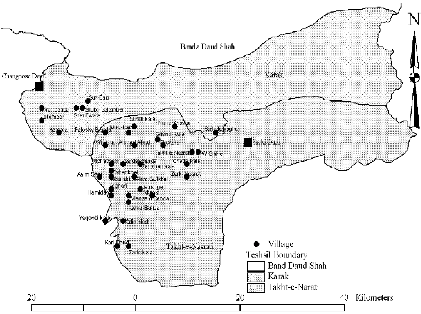
Spatial distribution of different villages in the study area
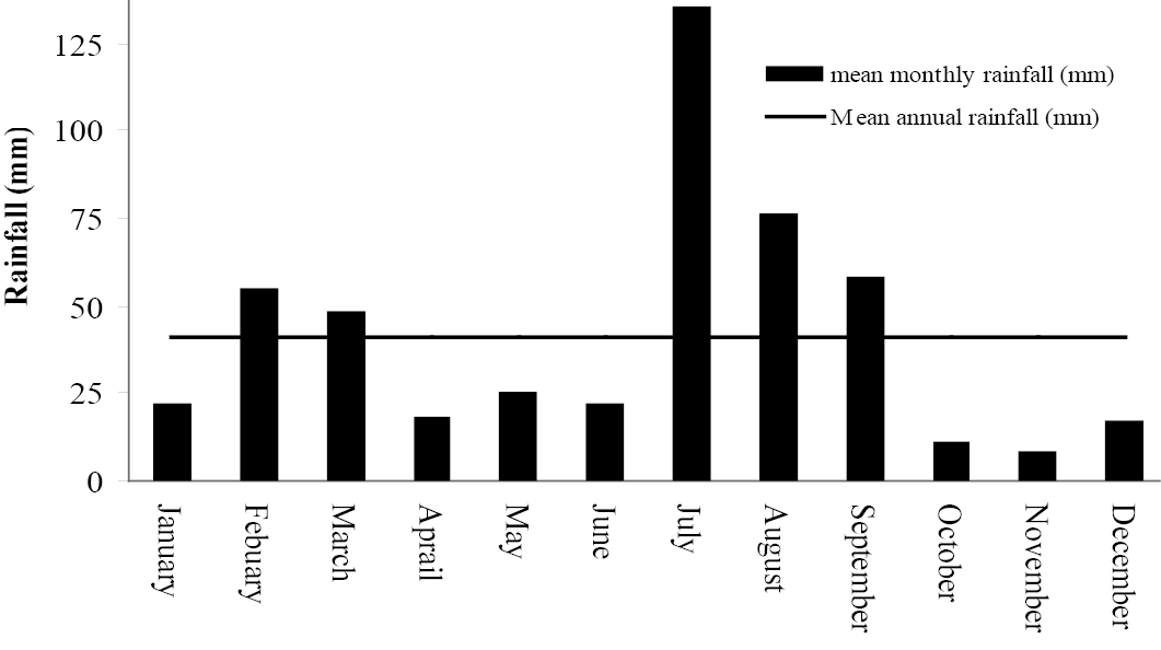
Mean monthly rainfall in Karak.
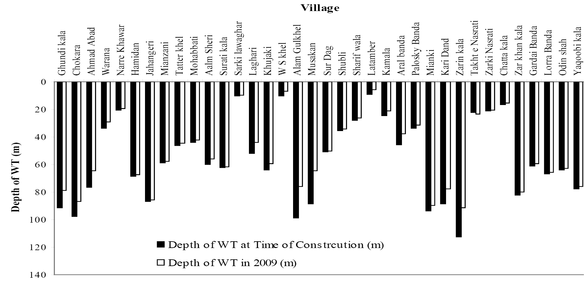
Ground water table depths in the wells of study area
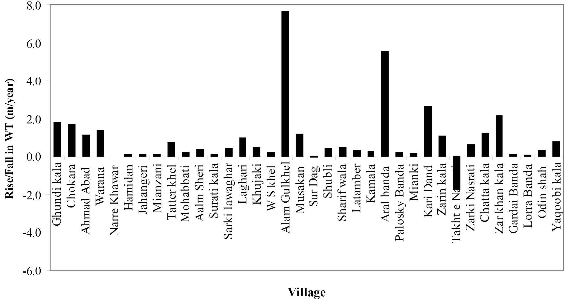
Annual increase/decline in the ground water table depths in the sampled wells
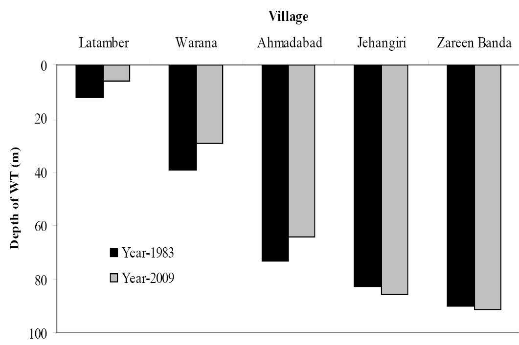
Areas with annual rise and decline in the ground water table depths in the sampled wells compared with wapda study conducted during 1983
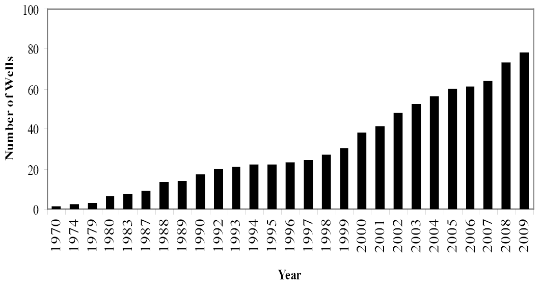
Increase in number of wells with time
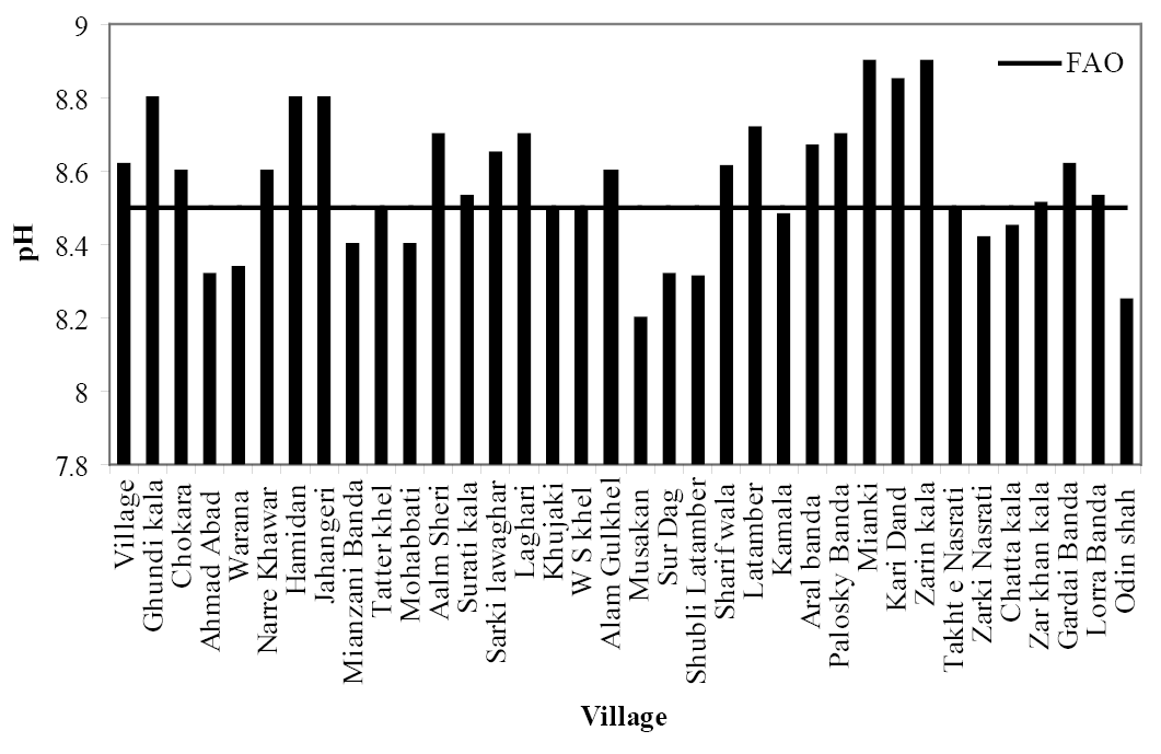
pH of the ground water in different villages
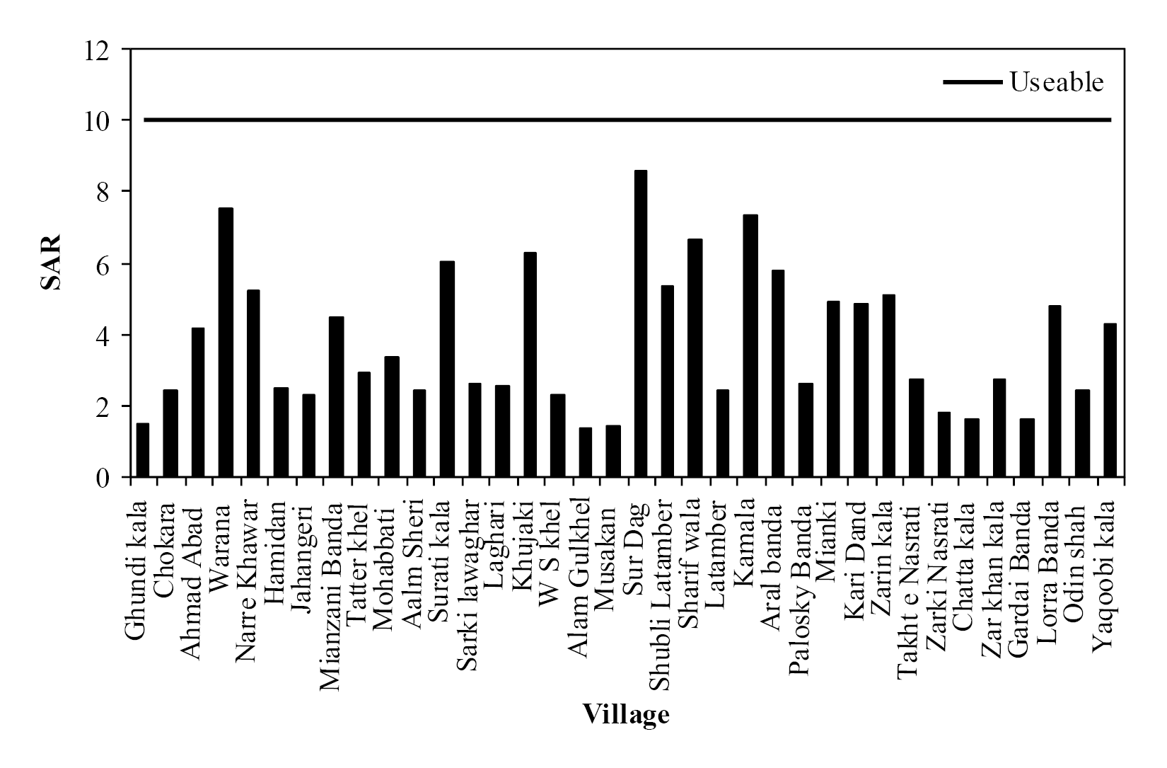
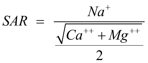
SAR of the Ground Water in Different Villages
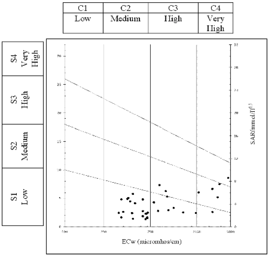
Richards salinity and sodicity diagram
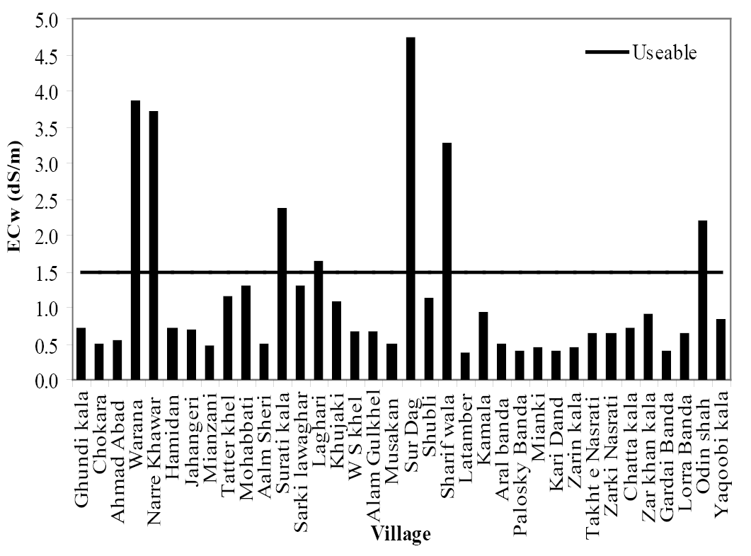
Ecw of the collected ground water samples


