
Land Use Land Cover Change Detection of District Lahore Using GIS and Remote Sensing (1993-2023)


Research Article
Land Use Land Cover Change Detection of District Lahore Using GIS and Remote Sensing (1993-2023)
Mohsin Rafique1*, Muhammad Atif Majeed2, Aamir Shakeel3, Tahir Iqbal4 and Ziad Raza5
Pakistan Forest Institute, Peshawar, Khyber Pakhtunkhwa, Pakistan.
Abstract | The urban landscape of Lahore, Pakistan, has undergone profound transformations from 1993 to 2023. This study employs advanced Geographic Information Systems (GIS) and Remote Sensing (RS) techniques to comprehensively analyze the evolving Land Use and Land Cover (LULC) patterns in the Lahore district. The research categorizes LULC into five key groups: Agriculture, Forest, Settlements, Barren Land, and Water Bodies, offering a detailed insight into these dynamic changes. Change detection analysis also underscores the dynamic nature of Lahore’s land use patterns. The findings demonstrate a noteworthy expansion of forested areas in three decades (1993-2023) almost 7 percent, driven by innovative initiatives like the Miyawaki forest method and ambitious afforestation projects. Significant shifts in land use land cover in Lahore includes a reduction of 31 percent in agricultural land, a rapid surge of 28 percent built-up area and urbanization, minor changes in water bodies, substantial forest growth, and slight declines in barren land. These transformations hold profound implications for urban planning, agricultural practices, and environmental conservation. The growth in forest cover has far-reaching ecological benefits, including improved air quality, climate change mitigation, and enhanced urban living quality. This research contributes valuable insights into the evolving urban landscape of Lahore, serving as a foundation for further studies and providing sustainable development strategies not only for the city but also for other rapidly urbanizing areas facing similar challenges.
Received | April 22, 2024; Accepted | June 09, 2024; Published | June 27, 2024
*Correspondence | Mohsin Rafique, Land Use Land Cover Change Detection of District Lahore Using GIS and Remote Sensing (1993-2023); Email: ziadraza.gispfi@gmail.com
Citation | Rafique, M., M.A. Majeed, A. Shakeel, T. Iqbal and Z. Raza. 2024. Land use land cover change detection of district Lahore using GIS and remote sensing (1993-2023). Pakistan Journal of Forestry, 74(1): 24-31.
DOI | https://dx.doi.org/10.17582/journal.PJF/2024/74.1.24.31
Keywords | Lahore, Pakistan, Geographic Information Systems (GIS), Object Based Image Analysis (OBIA), Remote sensing (RS), Land Use and Land Cover (LULC), Sustainable development strategies, Change detection
Copyright: 2024 by the authors. Licensee ResearchersLinks Ltd, England, UK.
This article is an open access article distributed under the terms and conditions of the Creative Commons Attribution (CC BY) license (https://creativecommons.org/licenses/by/4.0/).
Introduction
Land Use Land Cover (LULC) change, often driven by urbanization, population growth, and industrialization, has profound environmental impacts such as deforestation and shifts in natural landscapes (Foley et al., 2005; Seto et al., 2011). It is a global phenomenon driven by complex interactions between natural and human-induced factors (Rai et al., 2017; Briassoulis, 2020). Urbanization and human interference play significant roles in this process, often leading to the loss of agricultural land and unsustainable urban development (Seto et al., 2011; Li and Yeh, 2000). LULC changes are influenced by factors such as population growth, industrialization, deforestation, and climate change (Lambin et al., 2001; Rahman et al., 2012). To understand these changes, techniques like Remote Sensing (RS), Geographic Information Systems (GIS), and geospatial analysis are employed, utilizing data from satellite imagery and aerial photography (Weng, 2012). These changes have wide-ranging impacts, affecting weather patterns, biodiversity, water resources, and the urban environment (Kalnay and Cai, 2003; Gogoi et al., 2019), informing essential aspects of urban planning, watershed management, and environmental sustainability (Patra et al., 2018; Fan et al., 2017). In summary, LULC change is a global issue arising from intricate interactions between natural and human forces, necessitating thorough research and informed policy responses (Etefa et al., 2018; Turner et al., 1994).
Lahore, a rapidly expanding Pakistani city, experiences notable land use changes driven by urbanization, population growth, and economic development (Mumtaz et al., 2020; Shah and Ghauri, 2015). This shift leads to reduced green spaces due to urban sprawl and deforestation. Lahore’s cultural heritage requires vigilance in monitoring these changes for preservation and sustainable urban growth (Mumtaz et al., 2020). Economic development spurs land use alterations, emphasizing the need for a balance between growth and environmental conservation. Environmental concerns, including air pollution and vanishing green areas, underscore the importance of tracking and managing these changes (Masood et al., 2015). This research informs Lahore’s policies and has broader relevance for managing land use in rapidly urbanizing Pakistani cities, touching on urban dynamics, environmental conservation, heritage preservation, economic development, and evidence-based decision-making for sustainable growth.
This research aims to analyze land use and land cover changes in Lahore from 1993 to 2023, focusing on quantifying the extent and rate of change. It also involves classifying and mapping land use and land cover categories in Lahore, with a specific focus on vegetation, using Landsat imagery.
Materials and Methods
Study area description
Lahore, the capital of Punjab province in Pakistan, is a densely populated metropolis with approximately 13.5 million residents according to the 2022 Census Report. Covering 1,772 square kilometers, the city has doubled in size over the last two decades and is currently the 42nd most populous city globally, hosting around 6,300 people per square kilometer. The Lahore District consists of five tehsils: Lahore Cantonment, Lahore City, Model Town, Raiwind, and Shalimar. Geographically, Lahore is strategically located, bordered by Sheikhupura District to the north and west, Wagah to the east, and Kasur District to the south, with the Ravi River running along its northern boundary (Figure 1). The Lahore Division encompasses four districts: Kasur, Lahore, Okara, and Sheikhupura, with Lahore District covering 1,772 square kilometers. The region’s history and significance stem from its location as a crossroads between the East, the Middle East, and Central Asia, with an alluvial plain formed by sediment from five rivers, including the Sutlej, Beas, Ravi, Chenab, and Jhelum, and an average elevation of 702 feet above sea level.
Methodology
In this comprehensive study focused on Lahore district, we embarked on a journey to analyze land use and land cover changes over the years 1993, 2003, 2013, and 2023. Our data collection efforts involved sourcing imagery from the United States Geological Survey (USGS), obtained from various Landsat satellites. Precision was paramount, with shapefiles guiding our selection of image tiles while considering factors such as cloud cover, image type, and acquisition dates. We meticulously adhered to input parameters, keeping ground cover within a range of 0% to 5%. The choice of May for image acquisition ensured clear weather conditions, aligning with previous acquisitions. The World Geodetic System 1984 served as our reference datum, while the study area’s boundaries were extracted from the Survey of Pakistan. Employing a suite of software tools, including ArcGIS, Microsoft Excel, and Microsoft Word, we navigated through image preprocessing, stacking, study area extraction, and image enhancement. Supervised image classification emerged as a pivotal step, delineating various land cover categories in line with IPCC standards. To select samples for supervised classification, we used high-resolution Google Earth images and base maps to identify distinct land cover types. We then employed random and stratified sampling methods to ensure a representative selection of samples from various land cover categories. Samples were cross-referenced with ancillary data and field-verified, when possible, to ensure accuracy. These samples were used to train and validate the classification algorithm, ensuring reliable results. After extensive training, the maximum likelihood classification algorithm was deployed to generate land use and land cover maps for each year, affording insights into environmental changes. Further analysis included change detection, accuracy assessment through error matrices, and the calculation of overall accuracy and the kappa coefficient. On-site verification involved comparing classified images with historical Google Earth Pro images and previous land cover data. This process assessed the consistency of classifications with historical imagery and adjusted results as needed. Key metrics for supervised classifications in 1993, 2003, 2013, and 2023 included the Kappa coefficient and Overall Accuracy. Additionally, the Normalized Difference Vegetation Index (NDVI) was leveraged to assess vegetation health, with maps prepared using Arc Toolbox. This multifaceted methodology allowed us to comprehensively analyze land use changes and provided a robust foundation for informed decision-making in areas like resource allocation, urban planning, and environmental management.
Results and Discussions
This section is centered on the study’s primary goal, presenting findings through maps and tables that depict land use and cover in static, changing, and projected states for each category. The integration of GIS and RS techniques provides innovative data on land use changes. However, the precision of results depends on expert pixel-level analysis. The analysis encompasses five LULC categories: Agriculture, Forest, Settlements, Barren land, and Water Bodies. Our main focus was on the vegetation area, covering 1,653 square kilometers (165,341 hectares), to understand changes from 1993 to 2023.
Classification results of image 1993
According to the 1993 classification results, the Lahore district consisted of various land types. Water bodies covered about 1.83% (3,030.3 hectares) of the area, while agricultural land was the largest at 58.83% (97,266 hectares). Forest land accounted for 9.79% (16,187.31 hectares), settlements for 12.66% (20,928.3 hectares), and barren land for 16.89% (27,929.53 hectares). This data highlights the dominance of agricultural land and the relatively smaller proportion of water bodies. In 1993, the district was predominantly green, emphasizing the study’s focus on assessing temporal changes in vegetation areas using remote sensing techniques (Figure 2).
Classification results of image 2003
In 2003, similar to the 1993 process, the image underwent classification using ArcGIS. Significantly, some classes, like settlements, showed notable changes, likely due to environmental or human activities. Specifically, water bodies covered about 1.72% (2,851.11 hectares) of the Lahore district, while agricultural land dominated at 52.32% (86,500 hectares). Forest land accounted for 9.43% (15,587.53 hectares), settlements for 20.00% (33,068.2 hectares), and barren land for 16.53% (27,334.6 hectares) of the total area. Agriculture land was the most extensive category in the Lahore district, followed by settlements. Barren land, forest land, and water bodies followed in decreasing order of area coverage. The classification map in Figure 3 indicated an expansion of settlements in the district’s lower part.
Classification results of image 2013
In the 2013 image classification as shown in Figure 4, it was evident that agricultural land dominated, covering 37.44% of the total area (61,896.9 hectares), followed by settlements, accounting for 25.09% (41,484.13 hectares). Water bodies occupied 1.83% (3,020.94 hectares), while forest land represented 15.42% (25,496.28 hectares), and barren land covered 20.23% (33,443.19 hectares) of the total area. Notably, there was a rapid increase in the settlements category.
Classification results of image 2023
In the 2023 image classification, Settlements dominated the landscape, covering 41.14% of the total area (68,015.98 hectares) Figure 5, marking a significant increase. Conversely, water bodies occupied the smallest area at 1.89% (3,129.21 hectares). Agriculture Land, Barren Land, and Forest Land accounted for 23.54% (38,927.07 hectares), 16.22% (26,813.7 hectares), and 17.21% (28,455.48 hectares) of the Lahore district, respectively. The substantial growth in settlements is a notable concern, surpassing agricultural land coverage.
Normalized difference vegetation index (NDVI) analysis
Our study employed a comprehensive approach, combining qualitative and quantitative methods. Qualitatively, we analyzed satellite images to establish land use classifications, with a focus on Digital Number (DN) values. The Normalized Difference Vegetation Index (NDVI), a key remote sensing metric, played a central role. NDVI is vital for assessing vegetation health by comparing near-infrared (NIR) and red visible light bands in satellite imagery. Higher NDVI values indicate healthy vegetation, while lower values suggest less or stressed vegetation. Ranging from -1 to 1, NDVI serves numerous applications, from monitoring land use changes to detecting deforestation and assessing drought severity. Figure 6 presents consolidated NDVI maps for 1993, 2003, 2013, and 2023, with respective minimum and maximum values, ensuring precision. In 1993, NDVI ranged from -0.0268345 to 0.347939. In 2003, NDVI values spanned from -0.0635887 to 0.414366. For 2013, NDVI ranged from -0.118756 to 0.442574. In 2023, NDVI values varied from -0.0532776 to 0.480066.
Accuracy assessment
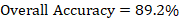
For data accuracy, ground verification points are crucial, involving on-site inspections at randomly selected locations. These points are chosen through random selection or confusion matrices. The process compares field-identified land use categories to mapped images, providing comprehensive insights. On-site verification for the past years was carried out by comparing the classified images with historical Google Earth Pro images and previous land cover data. This involved visually assessing the consistency between the classifications and historical imagery, integrating past land cover data to cross-check results, and making necessary adjustments based on these comparisons to ensure accuracy. This evaluation yields four critical metrics for supervised categorized images in 1993, 2003, 2013, and 2023, including the Kappa coefficient and overall accuracy.
The accuracy assessment for each year was computed using these formulas.


Accuracy assessment of 1993

Accuracy assessment of 2003


Accuracy assessment of 2013


Accuracy assessment of 2023


Change detection is at the heart of this research, offering crucial insights into Lahore’s evolving landscape. Over three decades, from 1993 to 2023, we meticulously analyze changes in land use and land cover categories. These alterations, marked by shifts in the dominance of specific classes, tell a compelling story of the district’s transformation.
In essence, change detection involves comparing land cover classifications over different time periods, allowing us to identify and measure changes. In this research, it provides a comprehensive view of Lahore’s ever-changing landscape. The key findings are summarized below:
From 1993 to 2023, Lahore’s landscape experienced substantial LULC changes. The findings reveal a remarkable increase in forested areas over the past three decades (1993-2023), The innovative approaches such as the Miyawaki urban forest in 2019-20 by Lahore development Authority and Restore Green and other extensive afforestation efforts like, Afforestation Lahore, and the Ten Billion Tree Tsunami Project (TBTTP) has resulted in increasing the forest cover up to 7 percent, In Lahore, land use and land cover have undergone significant changes, including a 31 percent decrease in agricultural land, a rapid 28 percent rise in built-up areas and urbanization, minor alterations in water bodies, considerable forest expansion, and slight reductions in barren land.
The decadal changes notably, from 1993 to 2003, water bodies slightly decreased by 0.11%, and agriculture declined by 6.51%, while settlements surged by 7.34%, signifying rapid urbanization. In the subsequent decade, water bodies increased slightly by 0.10%, but agriculture dropped significantly by 14.88%. Forest land grew by 5.99%, reflecting an increase in forested areas, and settlements expanded by 5.09%, underlining urbanization. Barren land increased by 3.69%.
From 2013 to 2023, water bodies increased by 0.07%, and agriculture continued to decrease by 13.89%. Forest land showed growth, with a 1.79% increase, but the most significant change was settlements, surging by 16.05%, indicating rapid urban expansion. Barren land decreased by 4.01%. Cumulatively from 1993 to 2023, water bodies increased slightly by 0.06%, and agriculture significantly decreased by 35.28%. Forest land exhibited a considerable 7.42% increase, signaling positive growth in forested areas. Notably, settlements showed a remarkable 28.48% increase, highlighting the rapid urbanization in Lahore, while barren land decreased by 0.67%. The growth in forested areas can be attributed to various initiatives, including the Miyawaki forest method and urban forestry projects, contributing to improved air quality and environmental conservation in the region.
The findings underscore profound transformations in Lahore’s Land Use and Land Cover (LULC) over the years. In 1993, Agriculture dominated at nearly 58.83%, with significant room for urban development. A decade later, Settlements surged, indicating urbanization, while in 2013, Agriculture decreased to 37.44%, highlighting urban growth. By 2023, Settlements dominated at 41.14%, emphasizing urban expansion. Fluctuations in NDVI values depict changes in vegetation health. Accuracy assessments revealed generally reliable results, with room for improvement.
In conclusion, this study illuminates Lahore’s dynamic LULC changes, urbanization, declining agriculture, and stable forests and water bodies. It impacts urban planning, agriculture, and environmental conservation. The rapid urbanization in 2023 prompts vital considerations for sustainable development, agricultural optimization, and vegetation health. This multifaceted transformation demands a strategic approach, emphasizing prudent land management and urban planning in tandem with policies for optimal land utilization. The consistent NDVI decline indicates potential vegetation stress and evolving land use patterns, emphasizing the real-world significance of these findings.
Conclusions and Recommendations
This study uncovers a compelling narrative of Lahore’s evolving landscape from 1993 to 2023, employing advanced GIS and RS techniques to comprehensively analyze Land Use and Land Cover (LULC) patterns. Visual interpretations and precise pixel-level analysis underpin the accuracy of the results.
A notable trend is the growth in forested areas, primarily from 2003 to 2013 and cumulatively from 1993 to 2023. This transformation can be attributed to initiatives like the Miyawaki forest method and afforestation projects, enhancing the ecological well-being of Lahore. These endeavors benefit air quality, climate change mitigation, and urban life quality.
Although accuracy assessments are generally reliable, there is room for improvement, particularly in rapidly evolving urban areas, as seen in the 2003 classification. Thus, continuous monitoring and enhanced accuracy assessments are essential for informed and sustainable land management practices.
Change detection highlights Lahore’s dynamic land use patterns, including a substantial decline in agriculture, a surge in urbanization, a slight increase in water bodies, notable growth in forests, and a slight decline in barren land. These shifts have profound implications for urban planning, agriculture, and environmental conservation.
The consistent use of the NDVI reveals fluctuations in vegetation health, emphasizing the need for ongoing monitoring to address challenges related to vegetation stress and evolving land use patterns.
In summary, this study calls attention to the transformative forces shaping Lahore’s landscape. It urges stakeholders to channel these changes towards a more sustainable, resilient, and prosperous future for the city and its residents.
The study’s findings lead to vital recommendations for Lahore’s sustainable development. These include balanced urban planning amidst increased urbanization, modernizing agricultural practices, ongoing forest conservation, sustainable water management, improved accuracy assessments, climate-resilient urban planning, continuous data collection, community involvement in land management, comprehensive land use policies, and public awareness campaigns. These measures ensure Lahore’s sustainable, resilient future while safeguarding its natural resources.
Acknowledgement
We acknowledge the role of GIS Branch, Pakistan Forest Institute, for providing us the opportunity to conduct this research.
Novelty Statement
This research presents a novel approach by employing advanced GIS and Remote Sensing techniques to provide a comprehensive analysis of the Land Use and Land Cover (LULC) transformations in Lahore, Pakistan, over a 30-year span (1993-2023). Unlike previous studies, it highlights a significant 7% growth in forest cover, attributed to innovative afforestation methods like the Miyawaki technique, while also documenting substantial shifts in agricultural and urban areas. The study’s integration of cutting-edge technology and focus on both ecological and urban dynamics offers critical insights for sustainable urban planning and environmental conservation strategies.
Author’s Contribution
Mohsin Rafique: Collected the data, performed the analysis and produced the map and final draft of this paper.
Muhammad Atif Majid: Performed the Analysis, specially related to the distribution of forest resources and helped in writing and structuring the research paper.
Aamir Shakeel: Conceived and designed the analysis and supervised the whole research work.
Tahir Iqbal: Assisted the research work and mapping activities done for this research.
Ziad Raza: Assisted the research work and mapping activities done for this research.
Conflict of interest
The authors have declared no conflict of interest.
References
Briassoulis, H., 2020. The web book of regional science sponsored by analysis of land use change: Theoretical and modeling approaches by helen briassoulis. pp. 248.
Etefa, G., A. Frankl, S. Lanckriet, D. Biadgilgn, Z. Gebreyohannes, Z. Amanuel, J. Poesen and J. Nyssen. 2018. Changes in land use/cover mapped over 80 years in the highlands of Northern Ethiopia. J. Geogr. Sci., 28(10): 1538–1563. https://doi.org/10.1007/s11442-018-1560-3
Fan, C., S.W. Myint, S. Kaplan, A. Middel, B. Zheng, A. Rahman, H.P. Huang, A. Brazel and D.G. Blumberg. 2017. Understanding the impact of urbanization on surface urban heat Islands-A longitudinal analysis of the oasis effect in subtropical desert cities. Remote Sens., 9(7). https://doi.org/10.3390/rs9070672
Foley, J.A., R. DeFries, G.P. Asner, C. Barford, G. Bonan, S.R. Carpenter, F.S. Chapin, M.T. Coe, G.C. Daily, H.K. Gibbs, J.H. Helkowski, T. Holloway, E.A. Howard, C.J. Kucharik, C. Monfreda, J.A. Patz, I.C. Prentice, N. Ramankutty and P.K. Snyder. 2005. Global consequences of land use. Science, 309(5734): 570–574. https://doi.org/10.1126/science.1111772
Gogoi, P.P., V. Vinoj, D. Swain, G. Roberts, J. Dash and S. Tripathy. 2019. Land use and land cover change effect on surface temperature over Eastern India. Sci. Rep., 9(1): 1–10. https://doi.org/10.1038/s41598-019-45213-z
Kalnay, E. and M. Cai. 2003. Impact of urbanization and land-use. Nature, 425(6939): 528–531. https://doi.org/10.1038/nature01675
Lambin, E.F., O.T. Coomes, B.L. Turner, H.J. Geist, S.B. Agbola, A. Angelsen, C. Folke, J.W. Bruce, O.T. Coomes, R. Dirzo, P.S. George, K. Homewood, J. Imbernon, R. Leemans, X. Li, E.F. Moran, M. Mortimore, P.S. Ramakrishnan, J.F. Richards and J. Xu. 2001. The causes of land-use and land-cover change: Moving beyond the myths, United Kingdom. Glob. Environ. Change, 11: 261–269. https://doi.org/10.1016/S0959-3780(01)00007-3
Li, X. and A.G.O. Yeh. 2000. Modelling sustainable urban development by the integration of constrained cellular automata and GIS. Int. J. Geogr. Inf. Sci., 14(2): 131–152. https://doi.org/10.1080/136588100240886
Masood, I., Z. Majid, S. Sohail, A. Zia and S. Raza. 2015. The deadly heat wave of Pakistan, June 2015. Int. J. Occup. Environ. Med., 6(4): 247. https://doi.org/10.15171/ijoem.2015.672
Mumtaz, F., Y. Tao, B. Bashir, A. Ahmad and L. Li. 2020. The relationship between vegetation dynamics and land surface temperature by using different satellite imageries. A case study of metropolitan cities of Pakistan. North Am. Acad. Res., NAAR, 2020. 3(7): 1–15.
Patra, S., S. Sahoo, P. Mishra and S.C. Mahapatra. 2018. Impacts of urbanization on land use /cover changes and its probable implications on local climate and groundwater level. J. Urban Manage., 7(2): 70–84. https://doi.org/10.1016/j.jum.2018.04.006
Rahman, A., S. Kumar, S. Fazal and M.A. Siddiqui. 2012. Assessment of land use/land cover change in the north-west district of Delhi using remote sensing and GIS techniques. J. Indian Soc. Remote Sens., 40(4): 689–697. https://doi.org/10.1007/s12524-011-0165-4
Rai, R., Y. Zhang, B. Paudel, S. Li and N.R. Khanal. 2017. A synthesis of studies on land use and land cover dynamics during 1930–2015 in Bangladesh. Sustainability (Switzerland), 9(10): 1–20. https://doi.org/10.3390/su9101866
Seto, K.C., M.F. and M.K.R. Burak Gu¨neralpa. 2011. A meta-analysis of global urban land expansion. PLoS One, 6(8): 9. https://doi.org/10.1371/journal.pone.0023777
Shah, B. and B. Ghauri. 2015. Mapping urban heat island effect in comparison with the land use, land cover of Lahore district. Pak. J. Meteorol., 11(22): 37–48.
Turner, B.L.I.I., W.B. Meyer and D.L. Skole. 1994. Global land-use/land-cover change: Towards an integrated study. Ambio, 23(1): 91–95.
Weng, Q., 2012. Remote sensing of impervious surfaces in the urban areas: Requirements, methods, and trends. Remote Sens. Environ., 117: 34–49. https://doi.org/10.1016/j.rse.2011.02.030
To share on other social networks, click on any share button. What are these?


