
Land Use Land Cover Change Detection of District Lahore Using GIS and Remote Sensing (1993-2023)

Land Use Land Cover Change Detection of District Lahore Using GIS and Remote Sensing (1993-2023)
Mohsin Rafique1*, Muhammad Atif Majeed2, Aamir Shakeel3, Tahir Iqbal4 and Ziad Raza5

Figure 1:
Study area map.
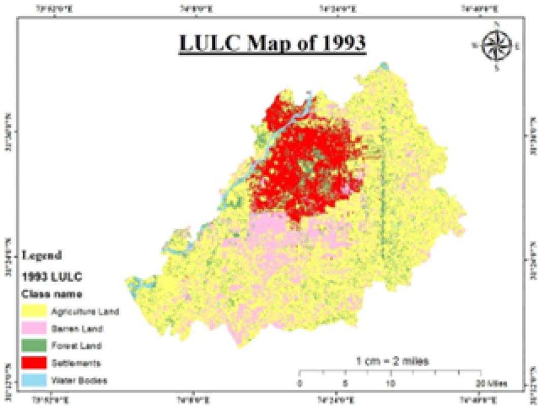
Figure 2:
LULC map of 1993.

Figure 3:
LULC map of 2003.
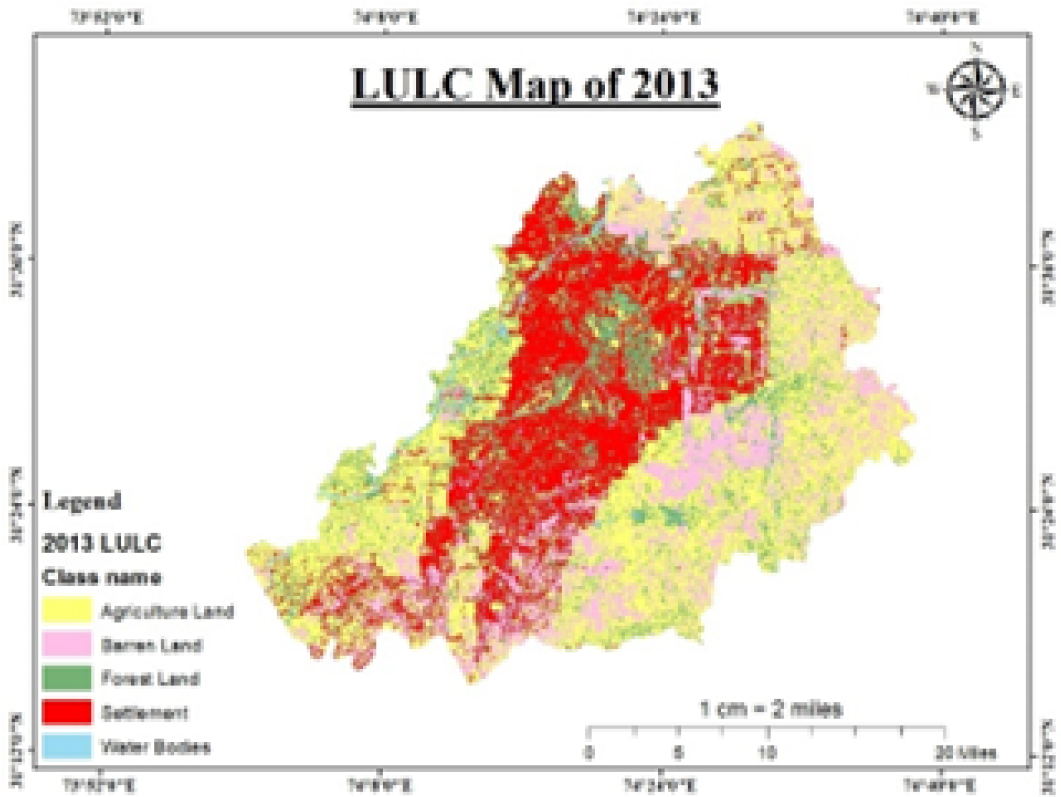
Figure 4:
LULC map of 2013.

Figure 5:
LULC map of 2023.

Figure 6:
NDVI maps.

Equation 1

Equation 2
Equation 3

Equation 4

Equation 5

Equation 6

Equation 7

Equation 8

Equation 9

Equation 10

June 2024
Vol. 74, Iss. 1

