
Impact of Karakoram Highway on Land use and Agricultural Development of Gilgit-Baltistan, Pakistan


Impact of Karakoram Highway on Land use and Agricultural Development of Gilgit-Baltistan, Pakistan
Salman Anwar1, 2*, Farhan Anwar Khan3 and Atta-ur-Rahman4
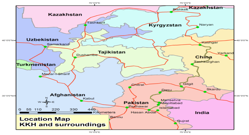
Location map of KKH and Gilgit-Baltistan modified after Said, 2005.
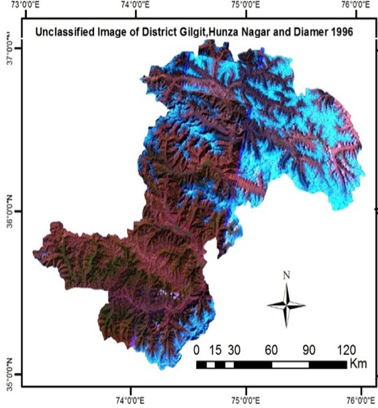
Landsat 5 multi-spectral image of District Hunza-Nagar, Gilgit and Diamer of September/November 1996.

Landsat 5 multi-spectral classified image of District Hunza-Nagar, Gilgit and Diamer of September/November 1996
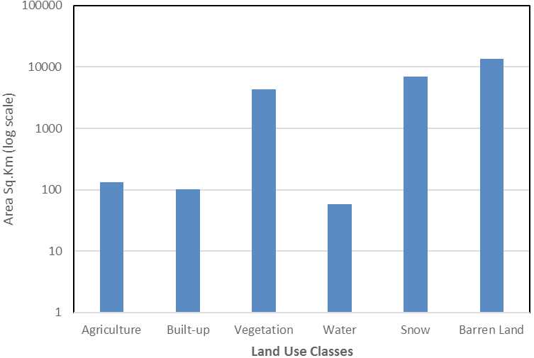
Gilgit-Baltistan, Land Use Land Cover of three sample districts 1996.
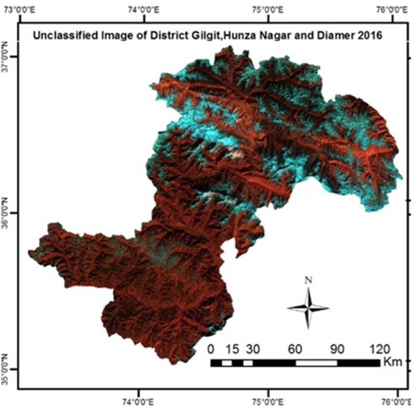
Multi-spectral pre-processed Landsat 8 image of three Sample districts of Gilgit-Baltistan of September/November 2016
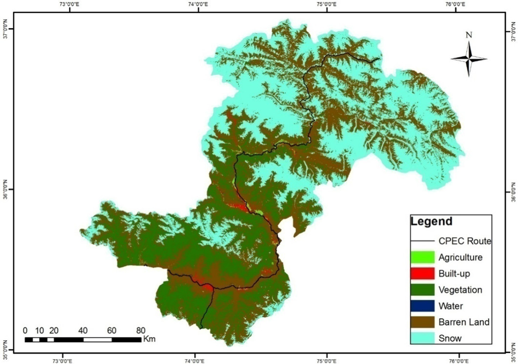
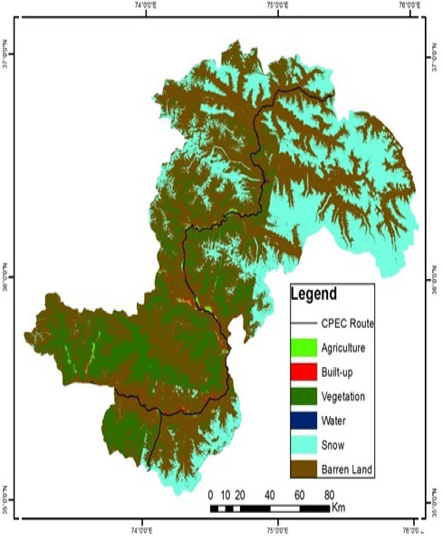
Gilgit-Baltistan, Landsat 8 classified image of Land Use Land Cover of three sample districts of November 2016.
Land Use/Land Cover of the Study area 2016 as per the Landsat image of November 2016.
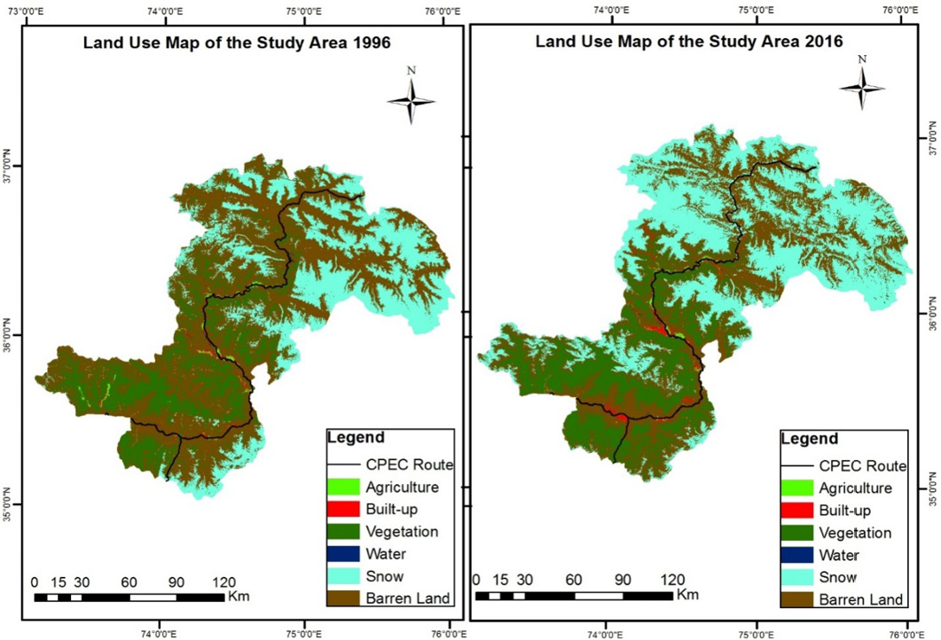
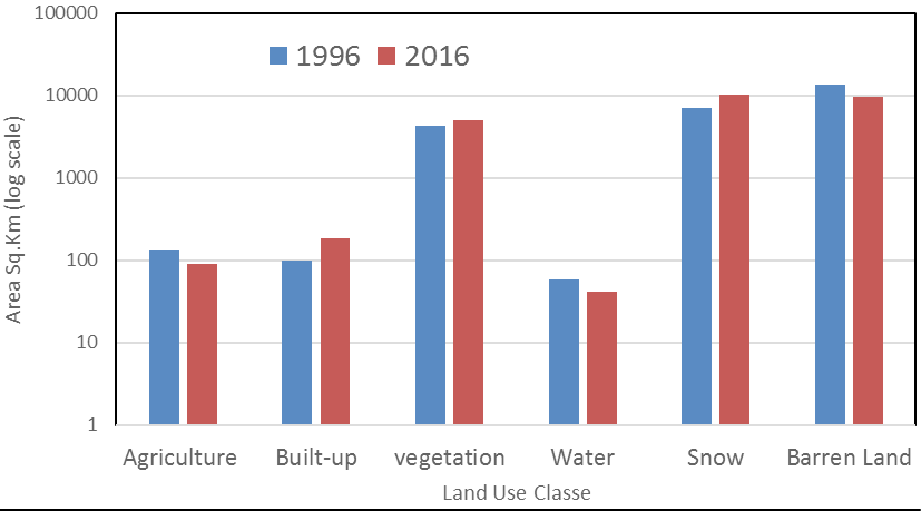
Gilgit-Baltistan, Land Use Land Cover Change Detection in three sample districts from 1996 and 2016

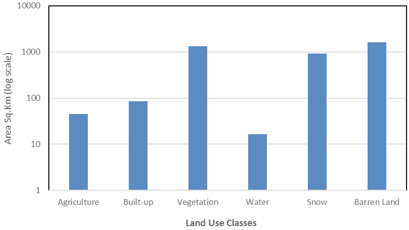
Land Use Land Cover Changes in three sample districts, 1996 and 2016.
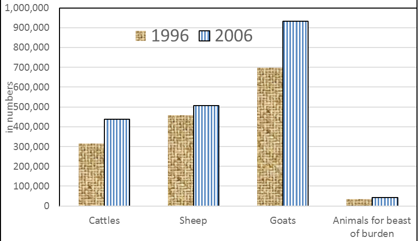
Gilgit-Baltistan, Changes in the number of livestock in 1996 and 2006 as per livestock and agriculture census.


