
Assessing Hydrological Characteristics in Iraq Dams


Assessing Hydrological Characteristics in Iraq Dams
Huda M. Hamid1, Fadia W. Al-Azawi2* and Zaid F. Makki3
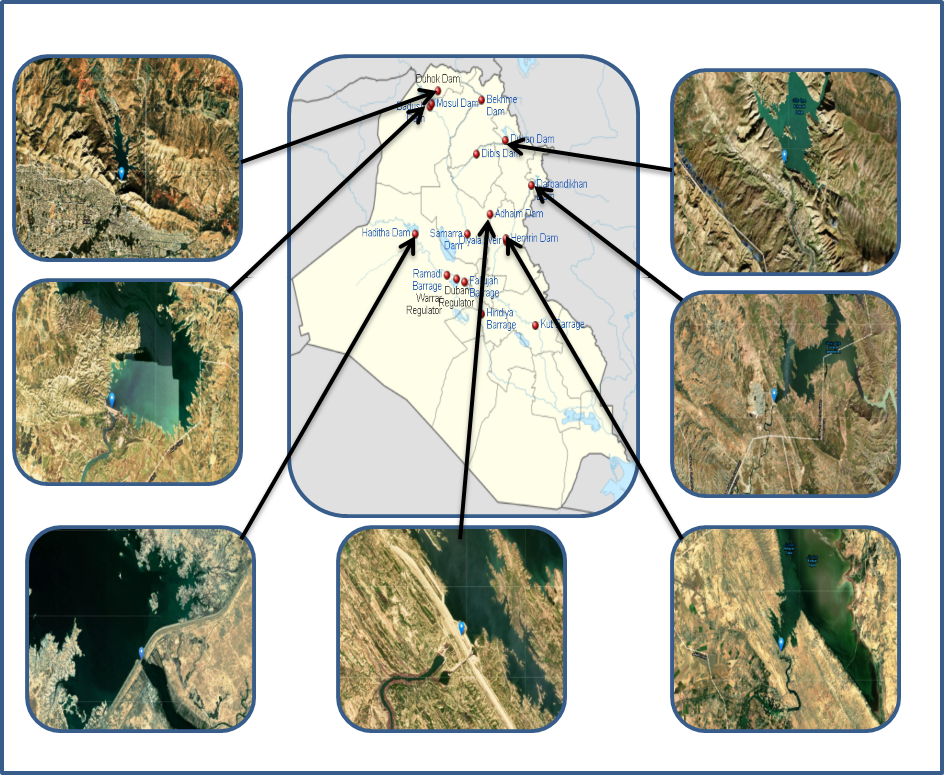
Figure 1:
The study area location, comprises seven DAMs of the ROI (Dokan, Darbandikhan, Hemrin, Haditha, Mosul, Dohuk, and Udhaim).
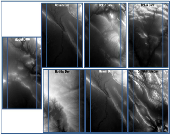
Figure 2:
DAM images SRTM1 accuracy was obtained for ROI to analyze the hydrology of study area.
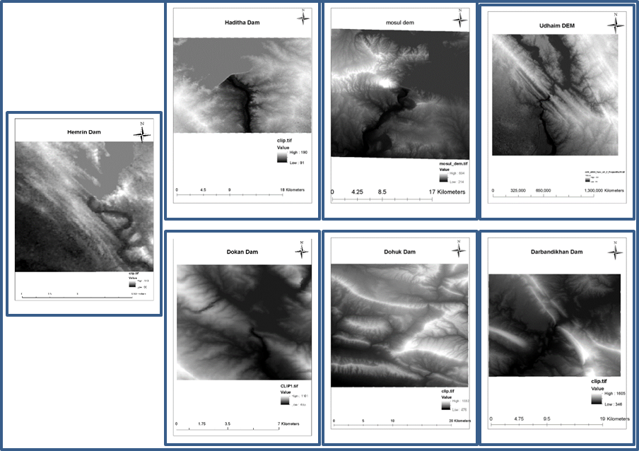
Figure 3:
Coordinate system converting from universal to metric form.

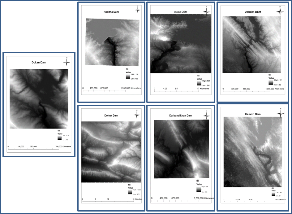
Figure 4:
Fill production of DAM.

Figure 5:
DAM flow direction.
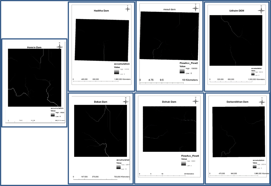
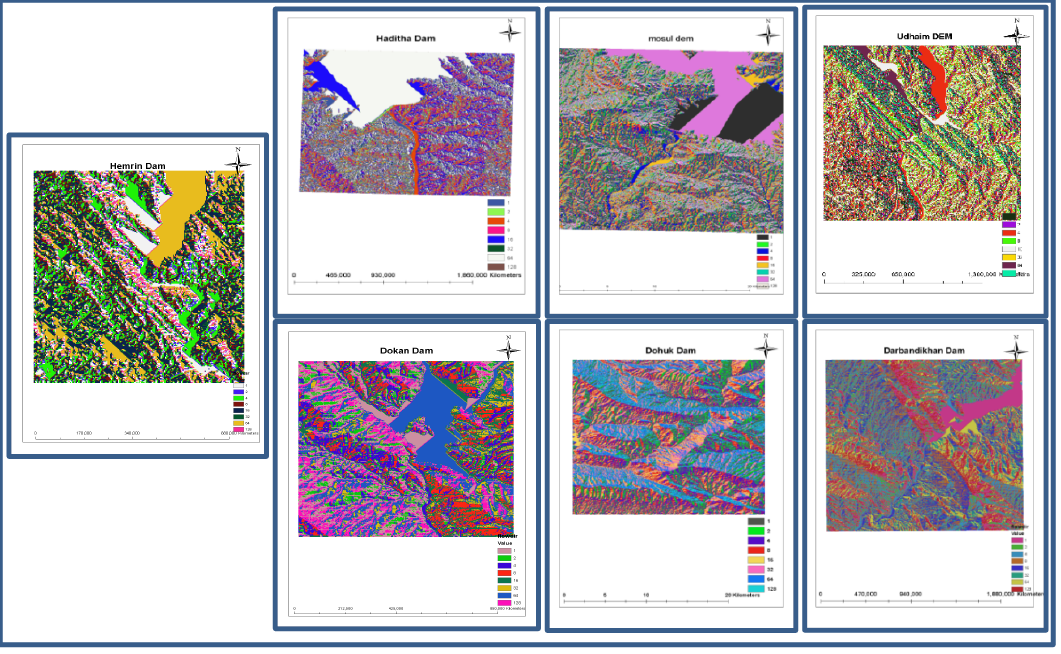
Figure 6:
Mesh flow clustered profile.
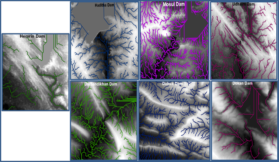
Figure 7:
The improvement in the agricultural area.
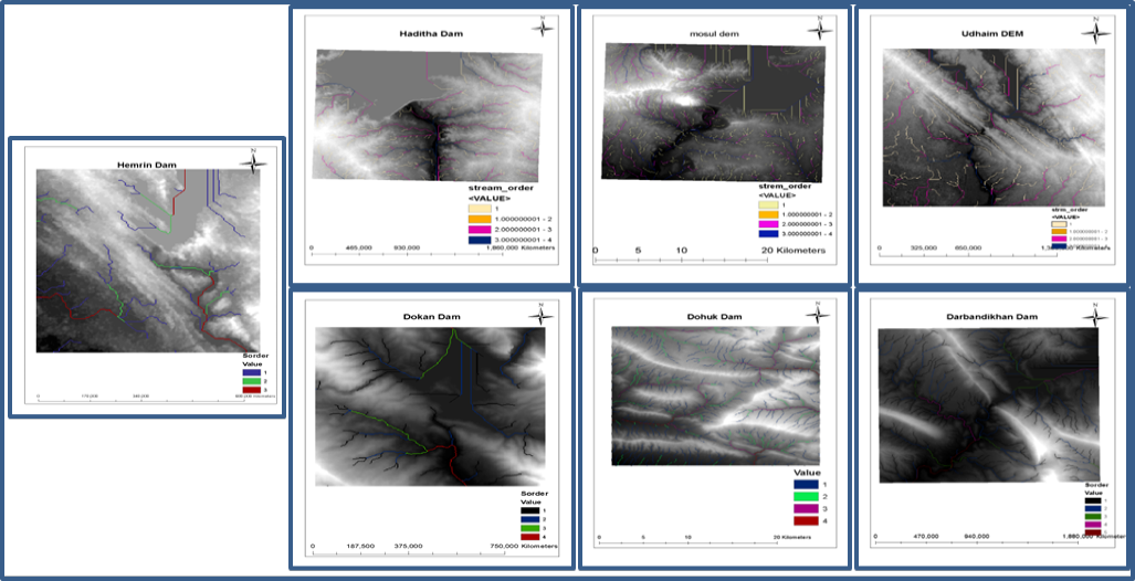
Figure 8:
Waterway division for the ROI.

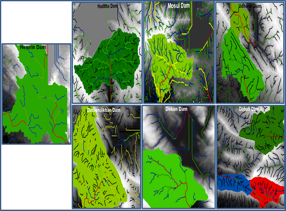
Figure 9:
Basin determination for the ROI.
March 2024
Vol.37, Iss. 1, Pages 1-87

