
Agricultural Water Poverty Index: A Tool for Agricultural Water Resources Management in District Dir Lower, Khyber Pakhtunkhwa, Pakistan


Agricultural Water Poverty Index: A Tool for Agricultural Water Resources Management in District Dir Lower, Khyber Pakhtunkhwa, Pakistan
Khalid Hussain, Muhammad Jamal Nasir*, Anwar Saeed Khan and Hafiz Ullah Khan
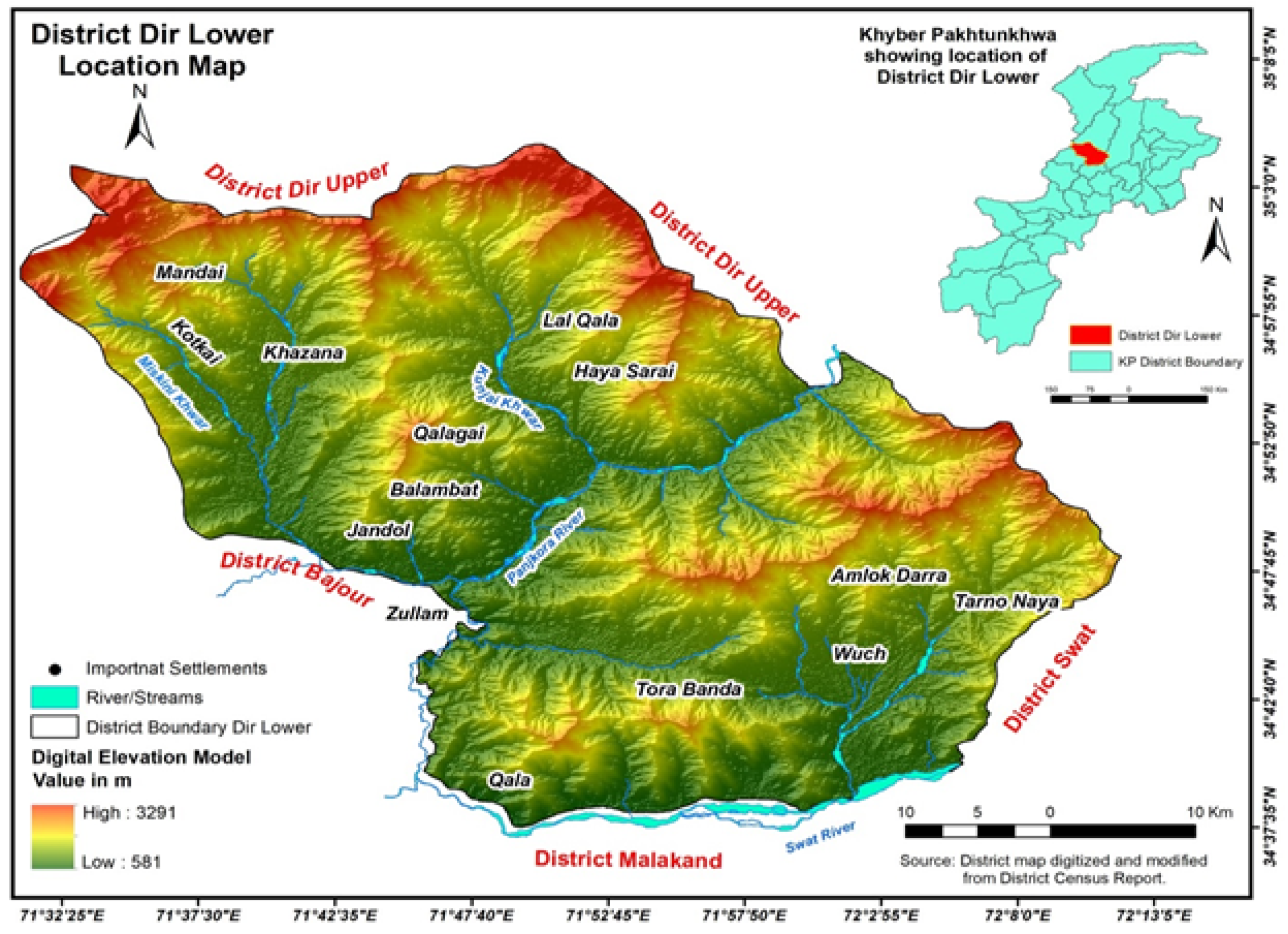
Location map of district Dir Lower.
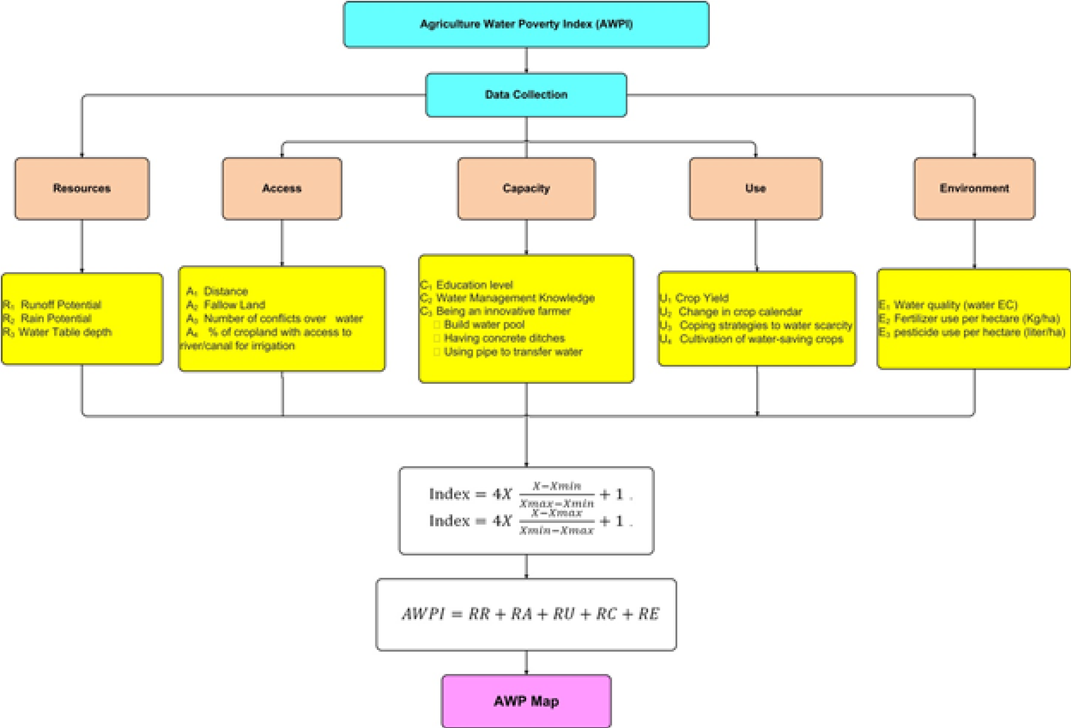
Illustrating the research methodology (after Nasir et al.,2021; Nihila et al., 2012).
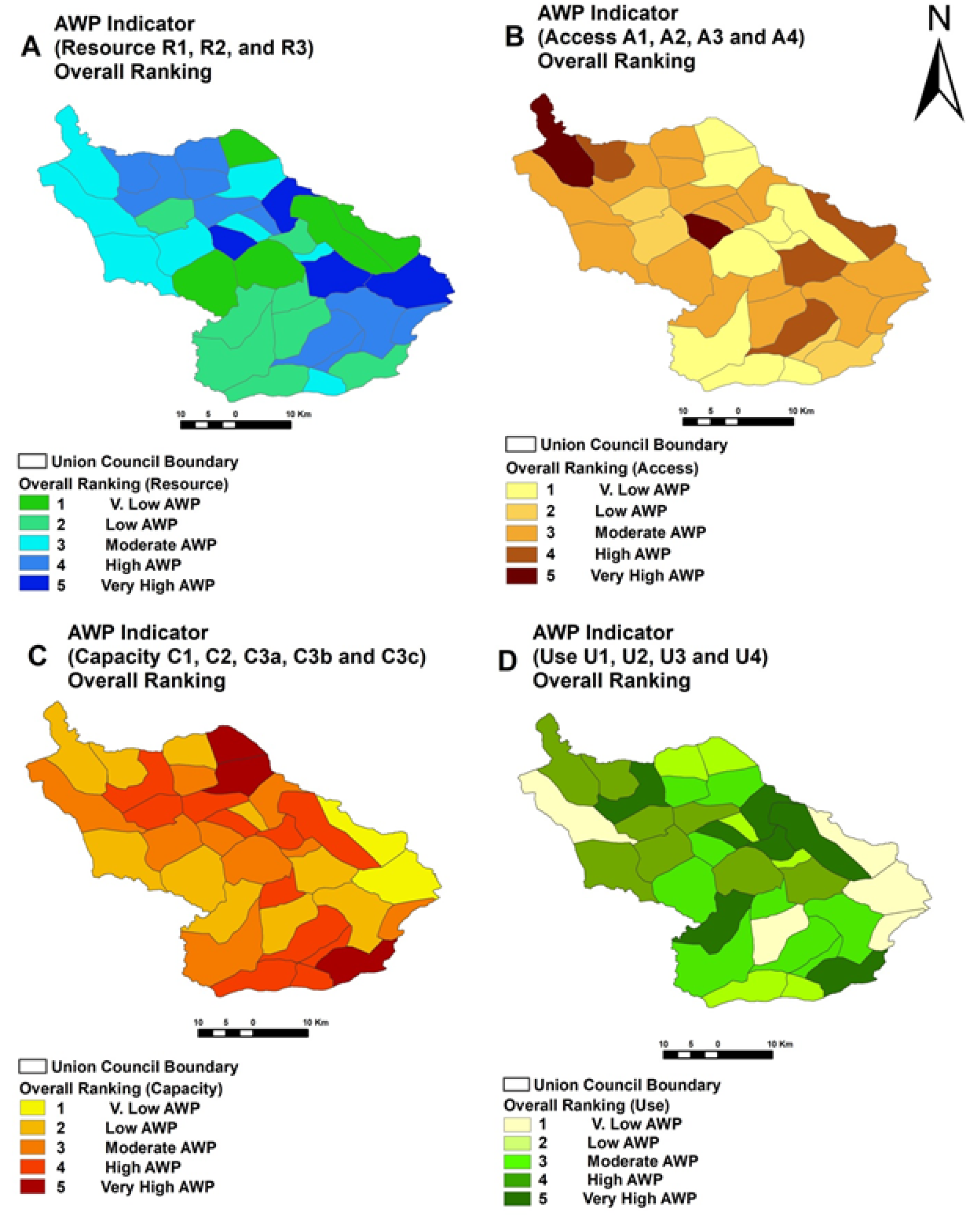
Union Council wise spatial distribution of various components of AWPI in the study area A) Resources B) Access C) Capacity and D) Use.
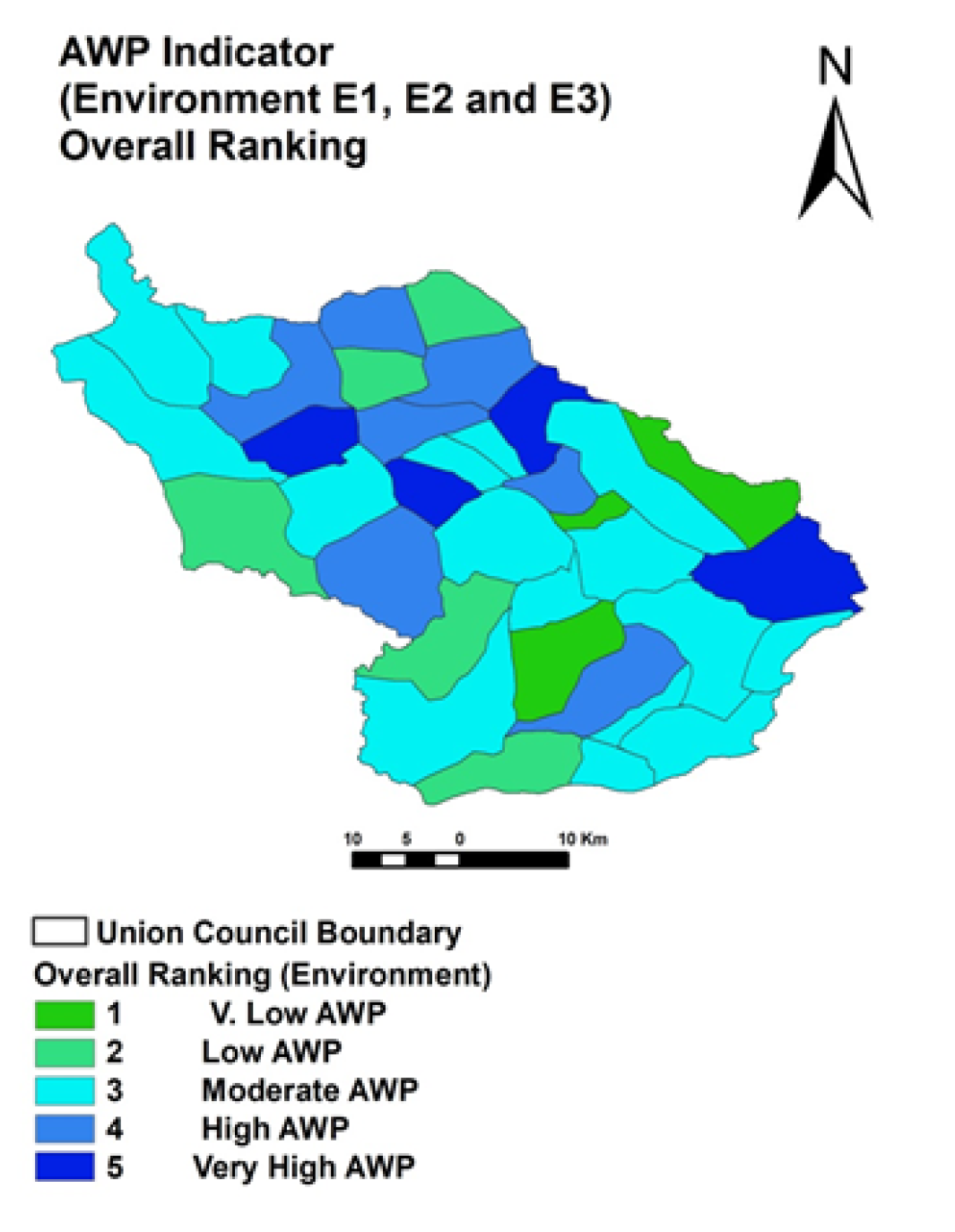
Overall Ranking of Sub-components of Environment Parameter (E1, E2 and E3).
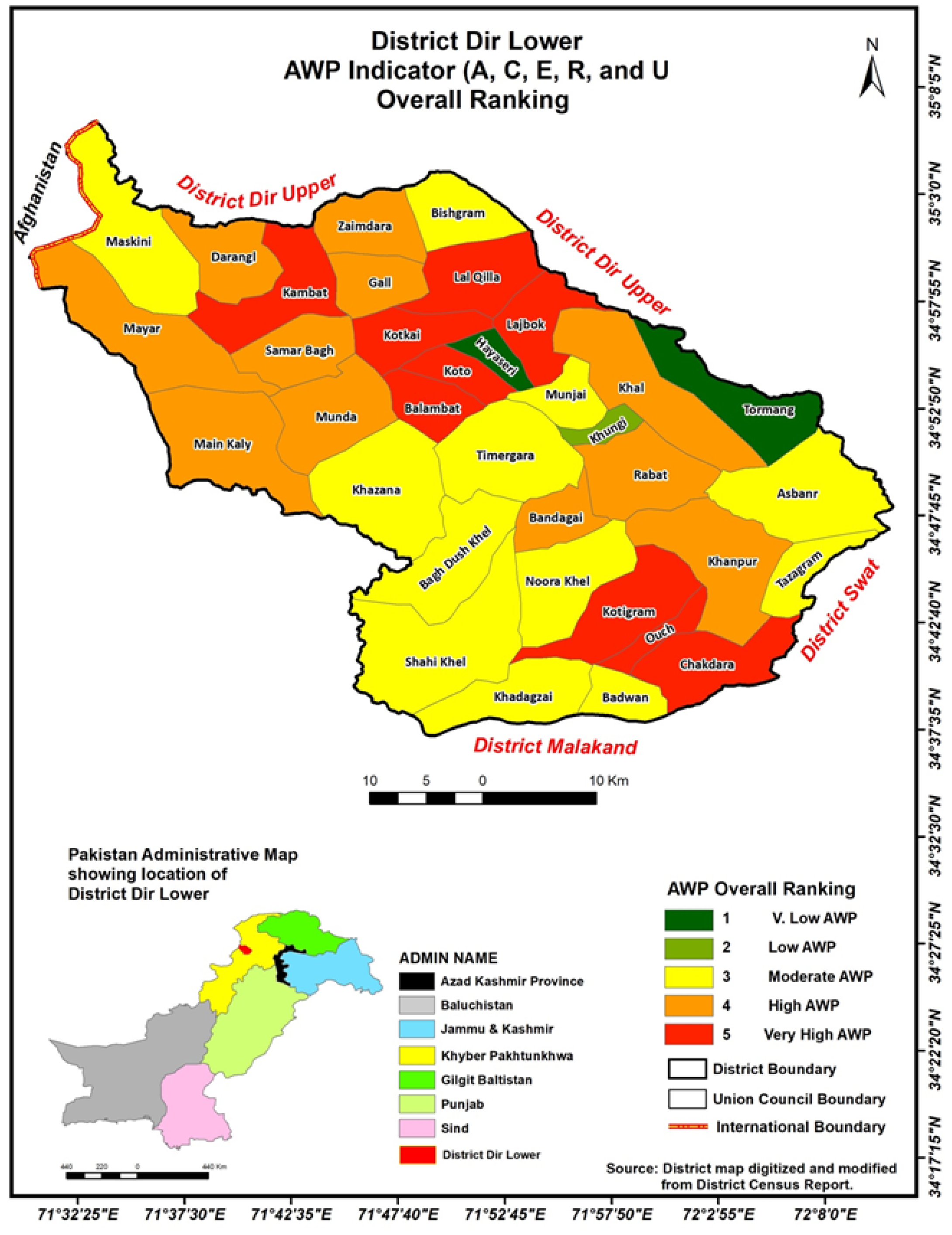
Illustrating the union council wise overall agriculture water poverty (AWP) distribution in the study area.
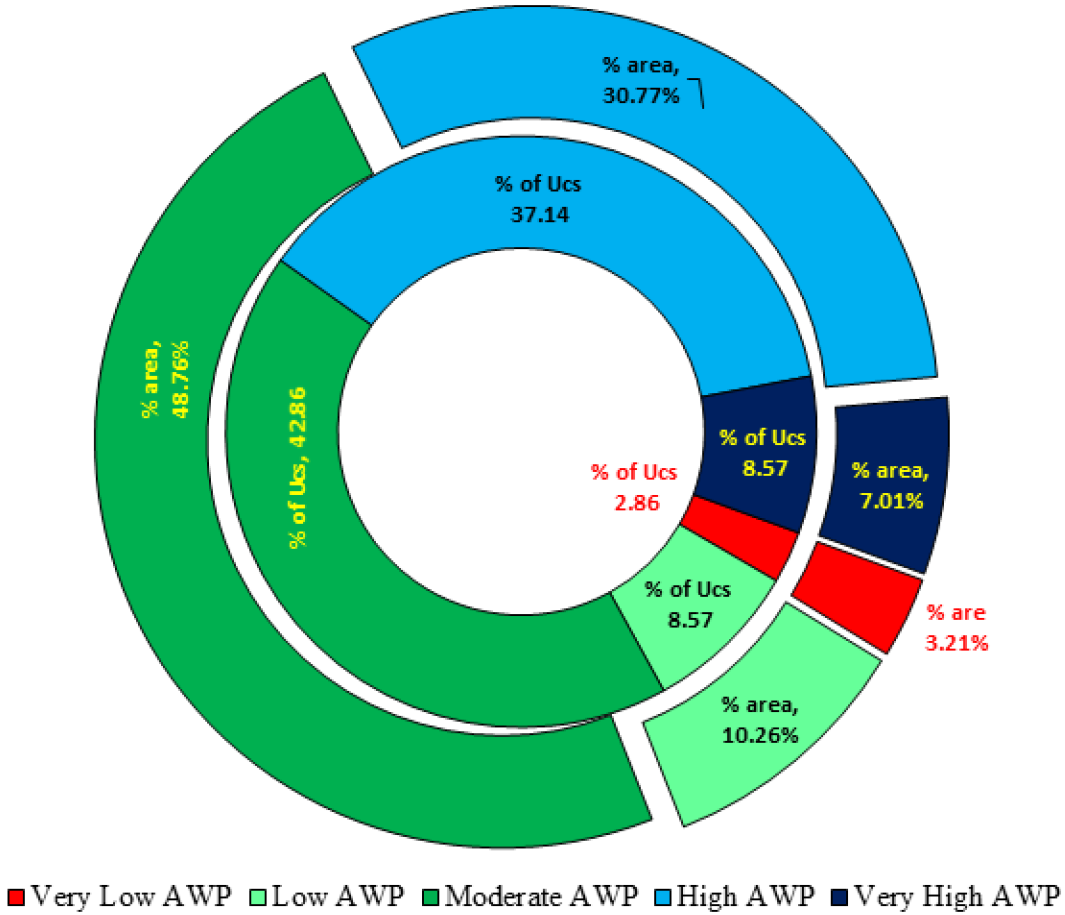
District Dir Lower, Percent area under various AWP classes VS Percent of UCs under various AWP classes.

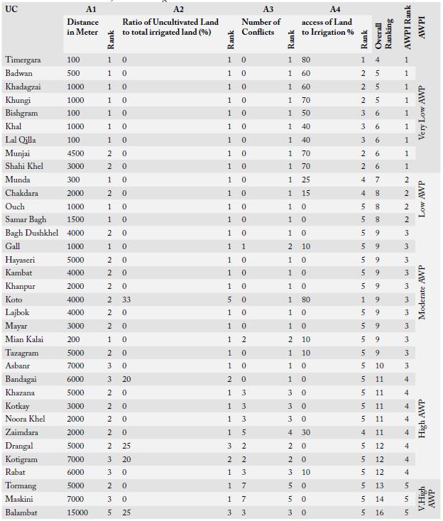
District Dir Lower, Access to Irrigation Water.
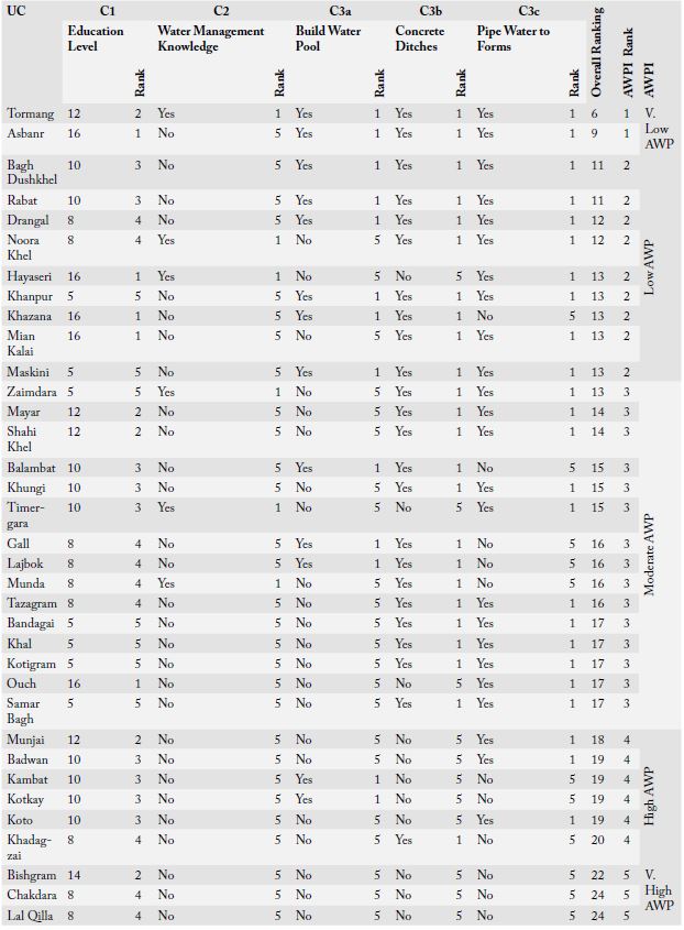
District Dir Lower farmers capacity to manage water resources.
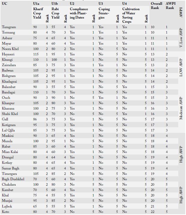
District Dir Lower Farmers efficient Use of Water Resource.


