Submit or Track your Manuscript LOG-IN

Two-decade Spatio-temporal Land Use and Cover Changes in District Shangla of Khyber Pakhtunkhwa, Pakistan

Two-decade Spatio-temporal Land Use and Cover Changes in District Shangla of Khyber Pakhtunkhwa, Pakistan

Shakeel Ahmad1, Muhammad Israr2*, Muhammad Amin3, Muhammad Sadiq Hashmi4, Nafees Ahmad5 and Rasheed Ahmad6
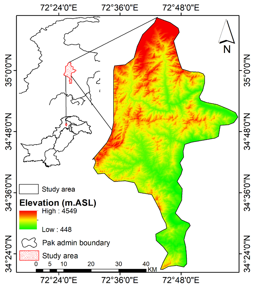
1School of Environment, Tsinghua University, Beijing 100084, China; 2Department of Rural Development, Faculty of Rural Social Sciences AMKC, Mardan, The University of Agriculture, Peshawar, Khyber Pakhtunkhwa, Pakistan; 3Department of Environmental Sciences, COMSATS University Islamabad, Abbottabad Campus, Abbottabad, 22060, Pakistan; 4Department of Economics, University of Malakand, Pakistan; 5Department of Soil and Climate Sciences, The University of Haripur, Pakistan.

 
*Correspondence | Muhammad Israr, Department of Rural Development, Faculty of Rural Social Sciences AMKC, Mardan, The University of Agriculture Peshawar, Khyber Pakhtunkhwa, Pakistan; Email: misrar@aup.edu.pk 

Figure 1:

Location of the study area in the Pakistan map.
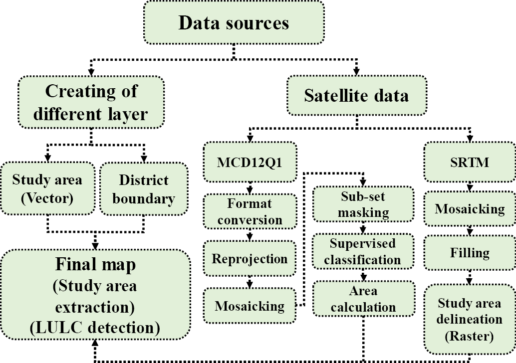
Figure 2:

Roadmap of data source.
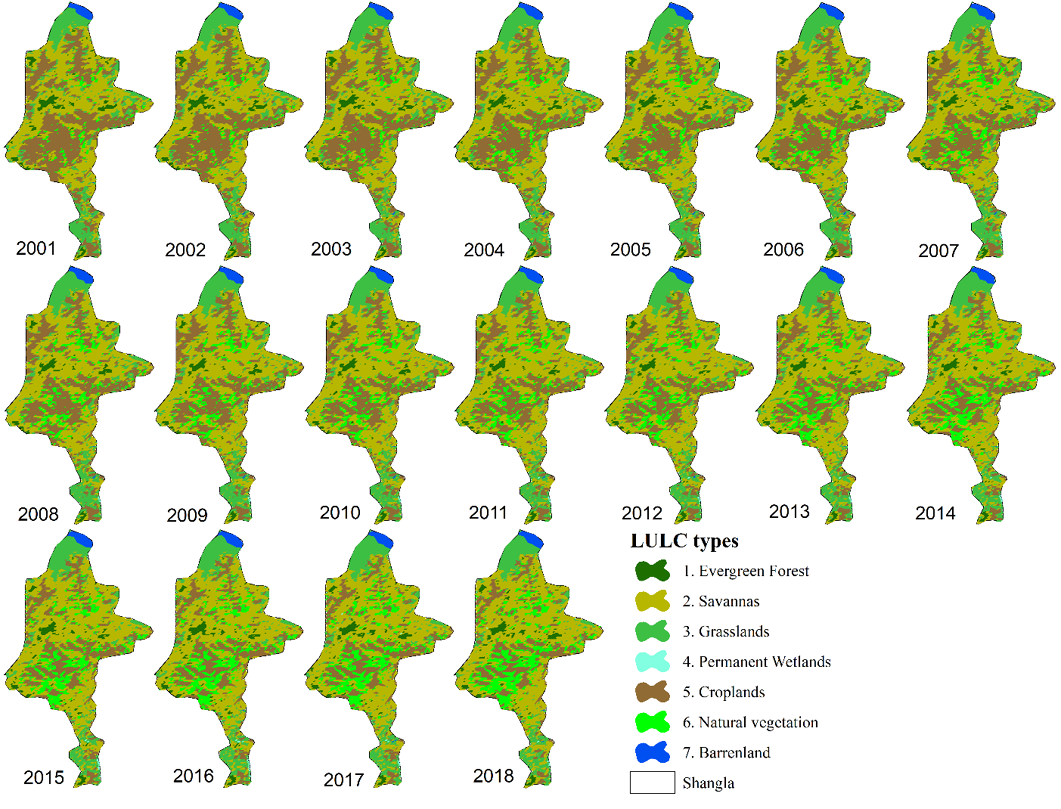
Figure 3:

Spatio-temporal change of land cover from 2001-2018.
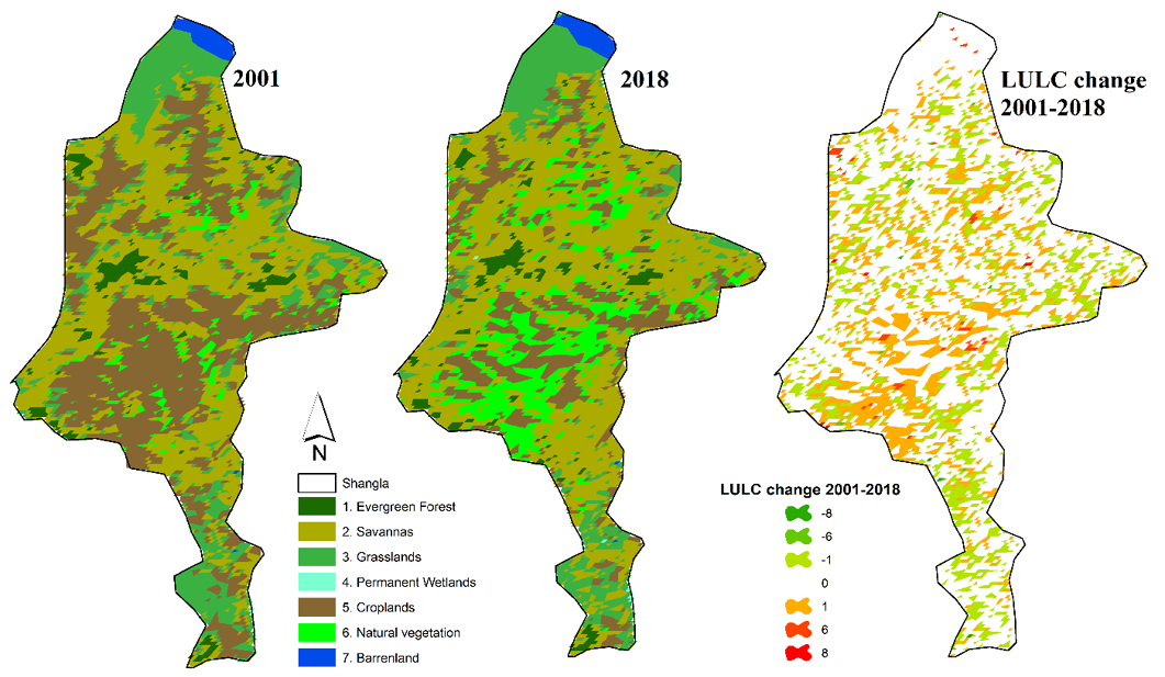
Figure 4:

Real LULC types change and types.
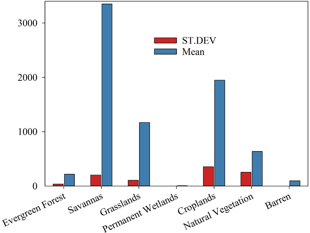
Figure 5:

Mean and standard deviation LULC types.

Sarhad Journal of Agriculture

March

Sarhad Journal of Agriculture, Vol.40, Iss. 1, Pages 01-262

Featuring

Click here for more

Subscribe Today

Receive free updates on new articles, opportunities and benefits


Subscribe Unsubscribe