Spatio-Temporal Expansion of Built-Up Areas and its Impact on Farmland and Food Security of Peshawar Valley, Pakistan
Spatio-Temporal Expansion of Built-Up Areas and its Impact on Farmland and Food Security of Peshawar Valley, Pakistan
Sajjad Ali1*, Atta ur Rahman1 and Sher Ali2
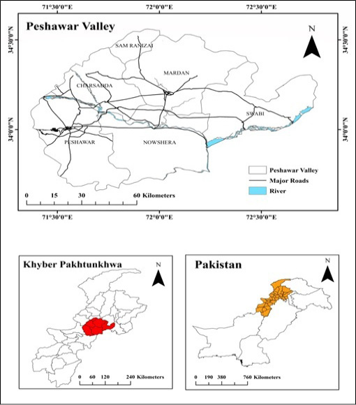
Location of the study area.
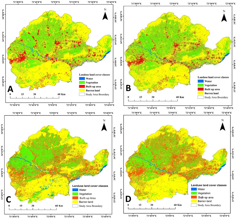
Land use land cover, 1990 (A); land use land cover, 2000 (B); land use land cover, 2010 (C); land use land cover, 2020 (D) Peshawar valley.
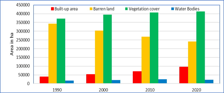
Peshawar valley, temporal changes in land use land cover, 1990-2020.
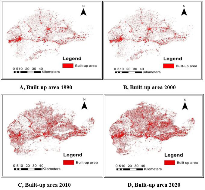
Peshawar valley, temporal changes in built-up area, 1990-2020.
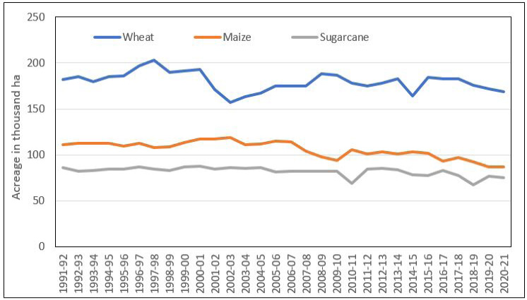
Peshawar valley, acreage in ha (000) of wheat, maize and sugarcane, 1990-2020.
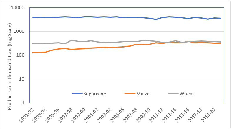
Peshawar valley, production in tons (000) of wheat, maize and sugarcane, 1990-2020.
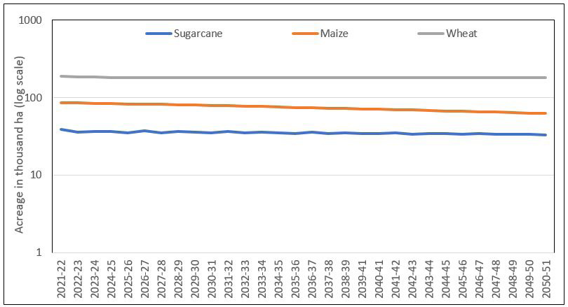
Peshawar valley, acreage in ha (000) of wheat, maize and sugarcane, 2021-2050.
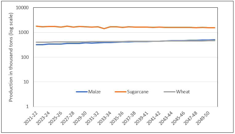
Peshawar valley, production in tons (000) of wheat, maize and sugarcane, 2021-2050.


