
Spatial and Temporal Analysis of Landholdings and Farm Fragmentation in Peshawar City District, Pakistan


Spatial and Temporal Analysis of Landholdings and Farm Fragmentation in Peshawar City District, Pakistan
Samiullah*, Mohammad Aslam Khan and Atta-ur-Rahman

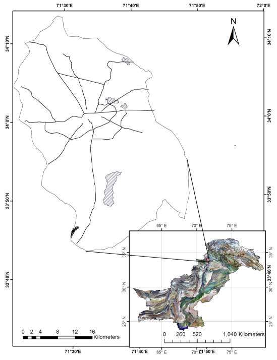
Figure 1
Location of capital city district Peshawar.
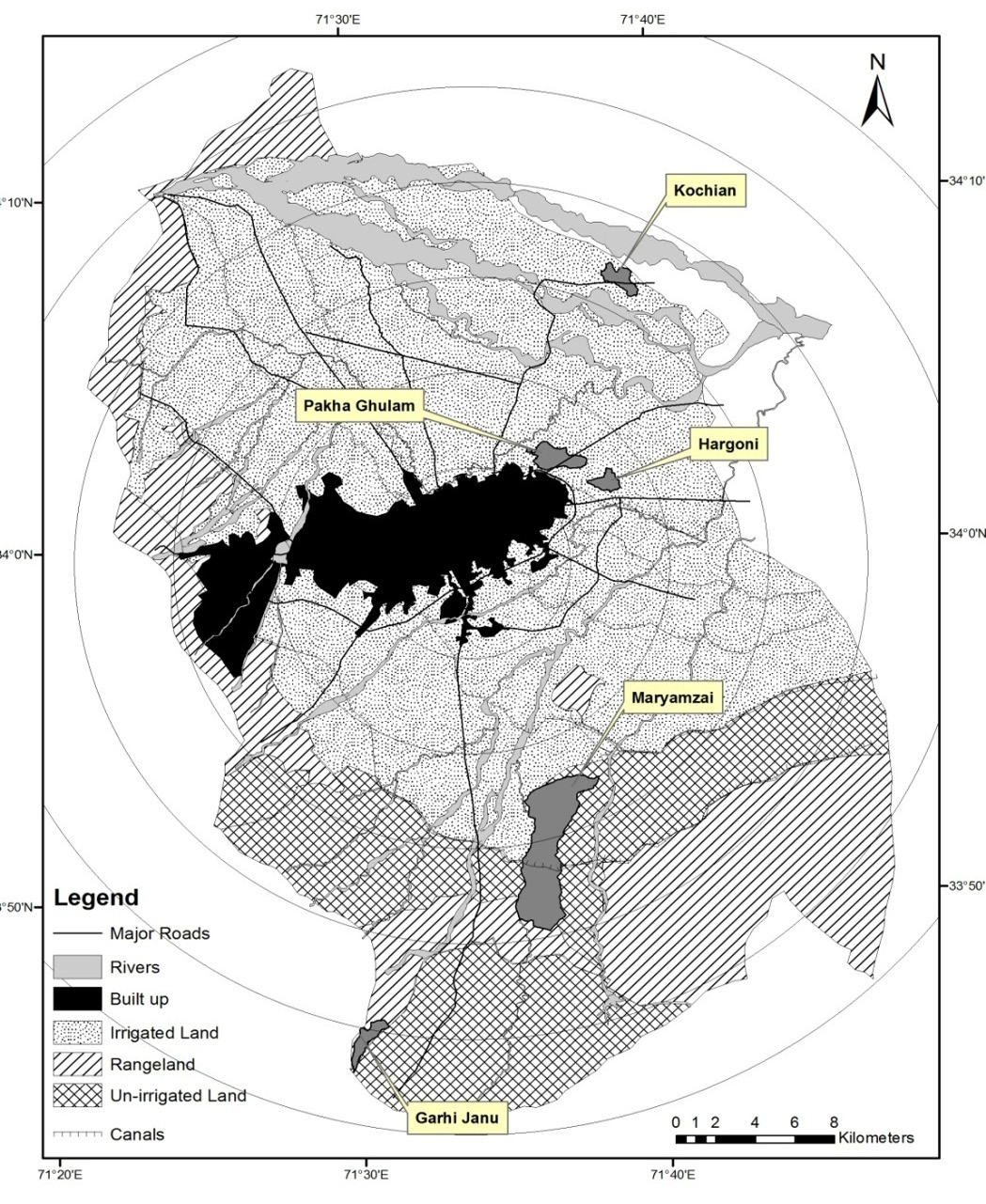
Figure 2
Location of sample villages in capital city district Peshawar.
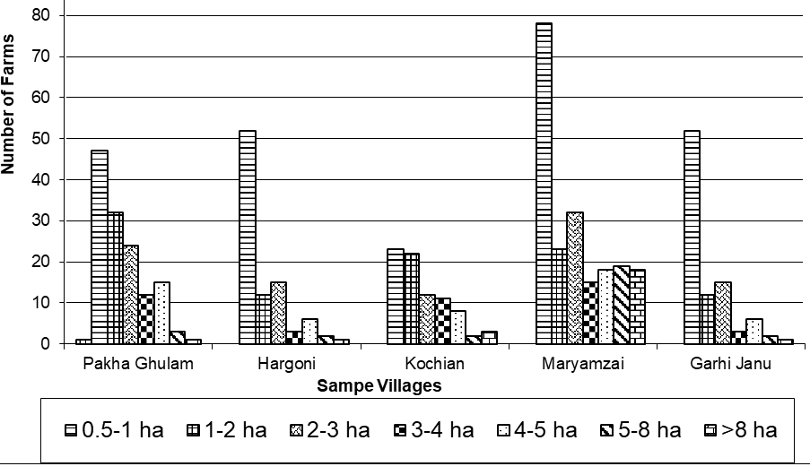
Figure 3
CCDP, Farm Ownership by size in Sample Villages.

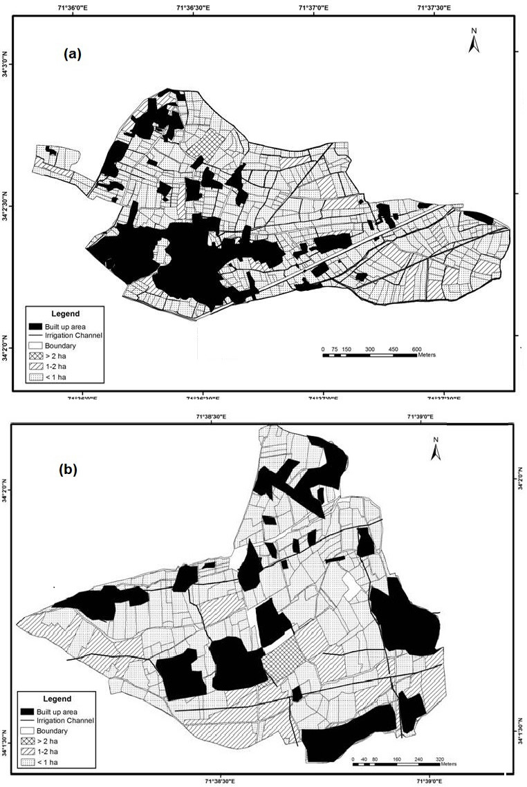
Figure 4
Farm Size in Villages (a) Pakha Ghulam and (b) Hargoni, 2011.

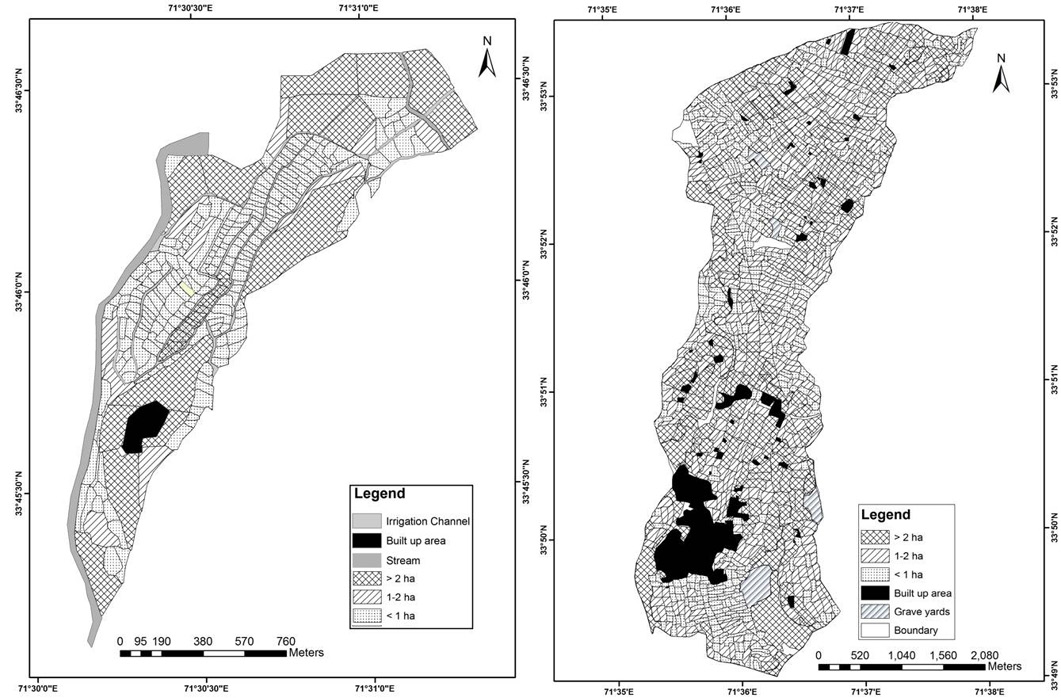
Figure 5
Farm Size in Garhi Janu and Maryamzai, 2012.
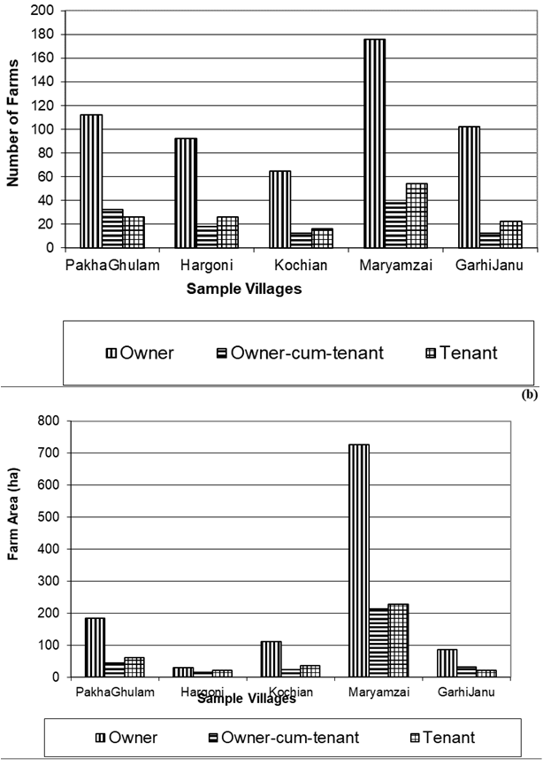
Figure 6
Tenure by (a) Number of farms (b) Area, 2012;

Figure 7
Farm fragmentation in Kochian between 1991 and 2012.
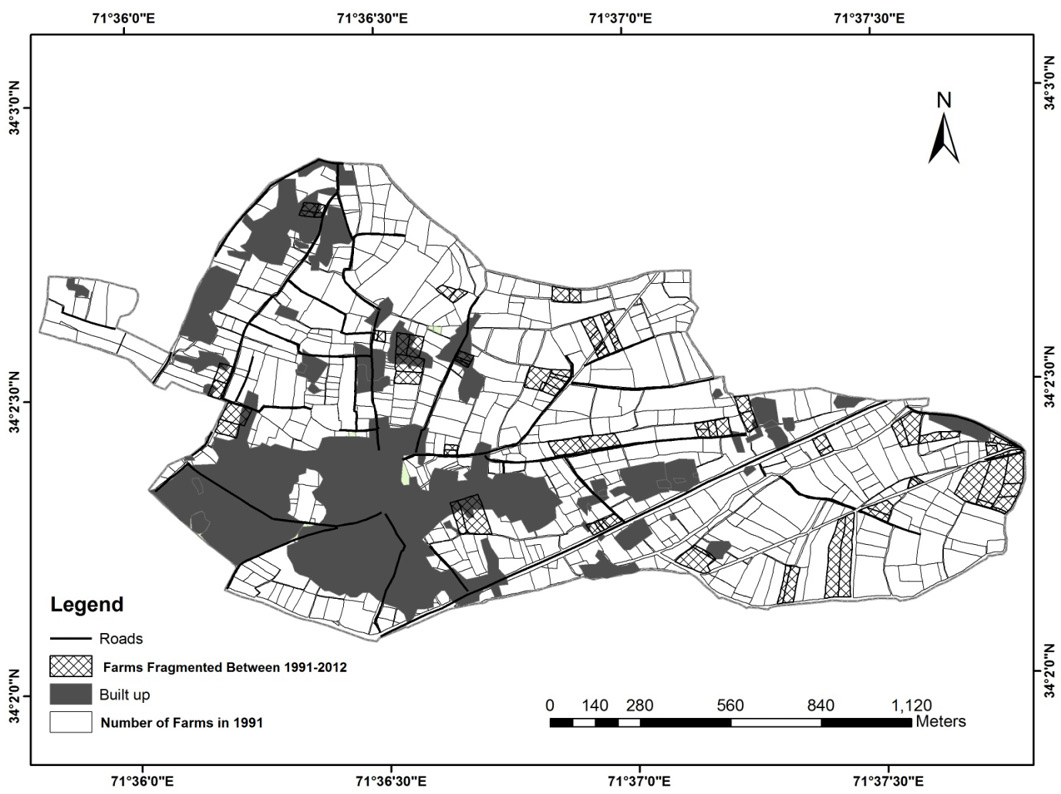
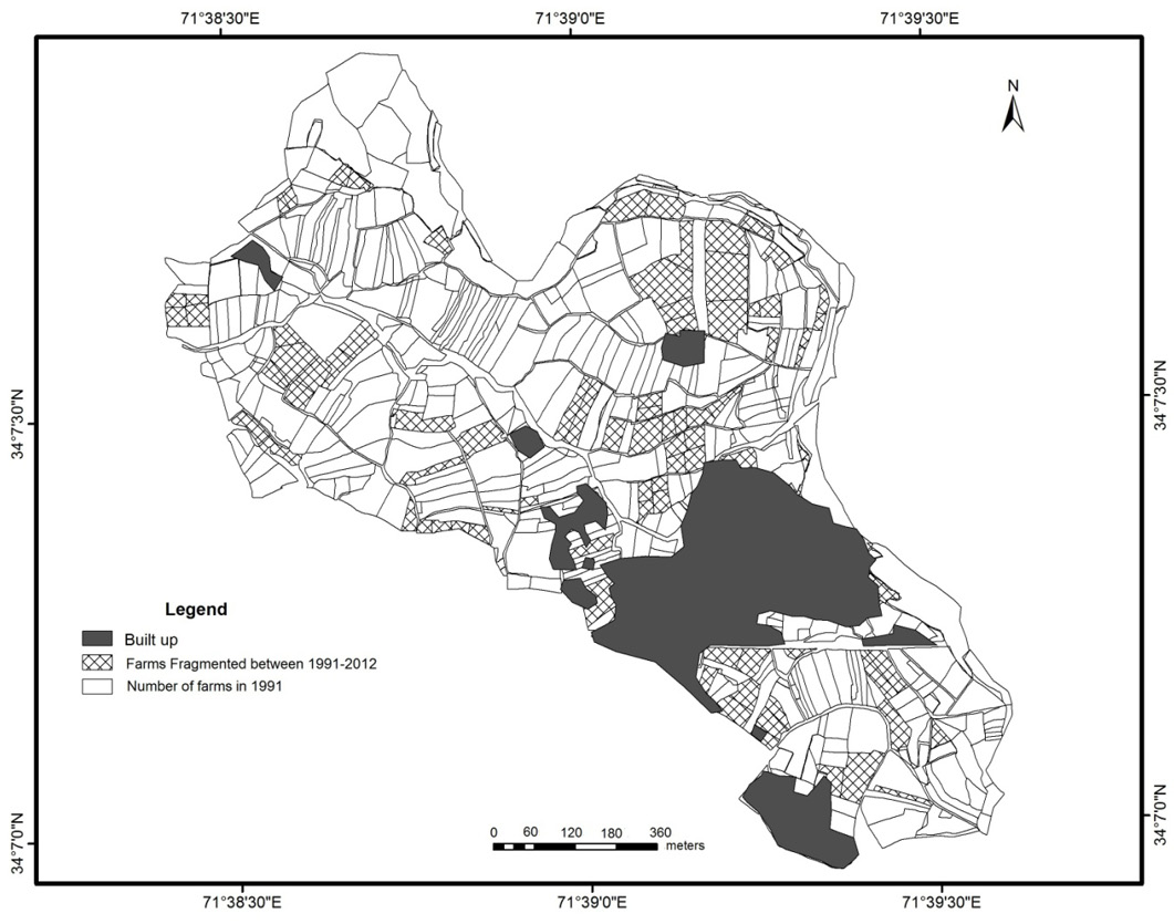
Figure 8
Farm fragmentation in Pakha Ghulam between 1991 and 2012.

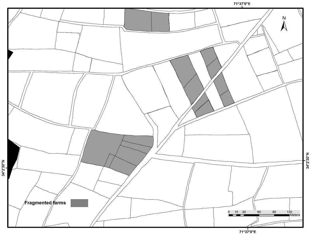
Figure 9
Fragmentation of a sample farm in Pakha Ghulam (rain fed and irrigated).

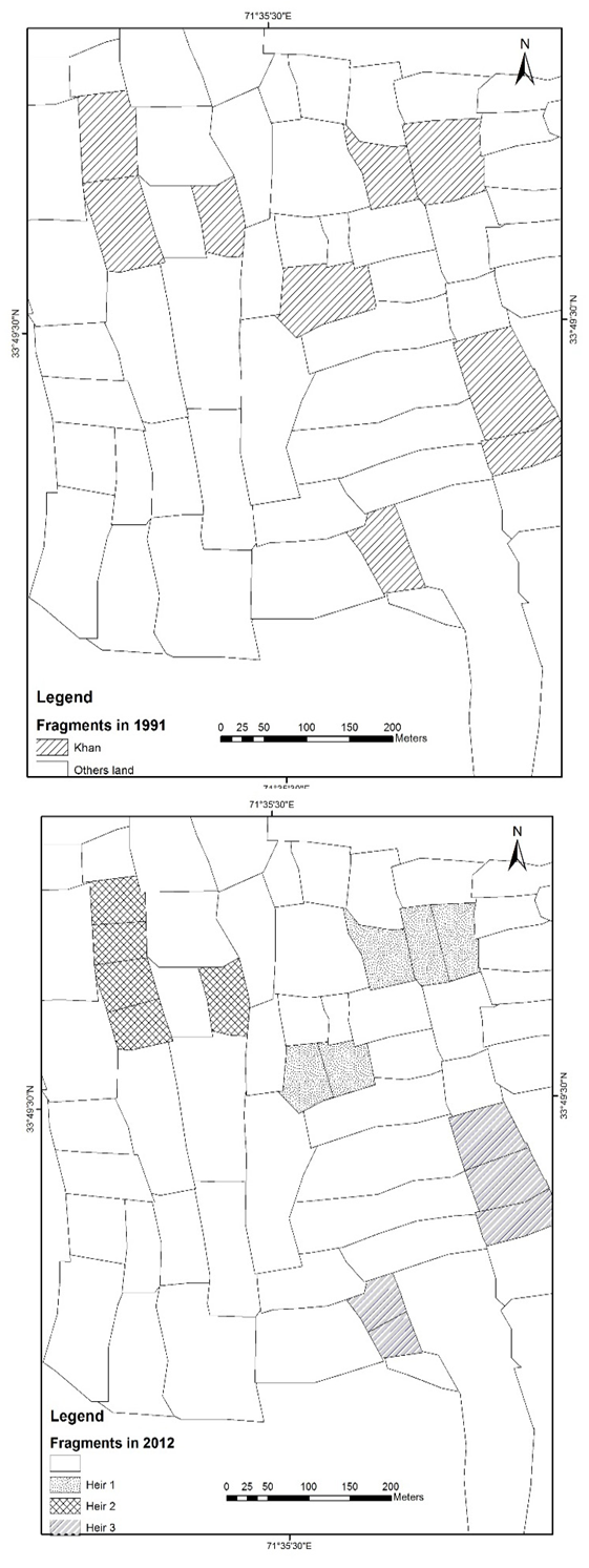
Figure 10
Fragmentation of a sample farm in Maryamzai (rain fed area).
September 2018
Vol. 34, Iss. 3, Pages 494-711


