
Land Cover and Land Use Change Detection Using Object-Based Image Analysis in Kaghan Valley, Khyber Pakhtunkhwa

Land Cover and Land Use Change Detection Using Object-Based Image Analysis in Kaghan Valley, Khyber Pakhtunkhwa
Aamir Shakeel1*, Anwar Ali2, Tahir Iqbal1 and Ziad Raza1
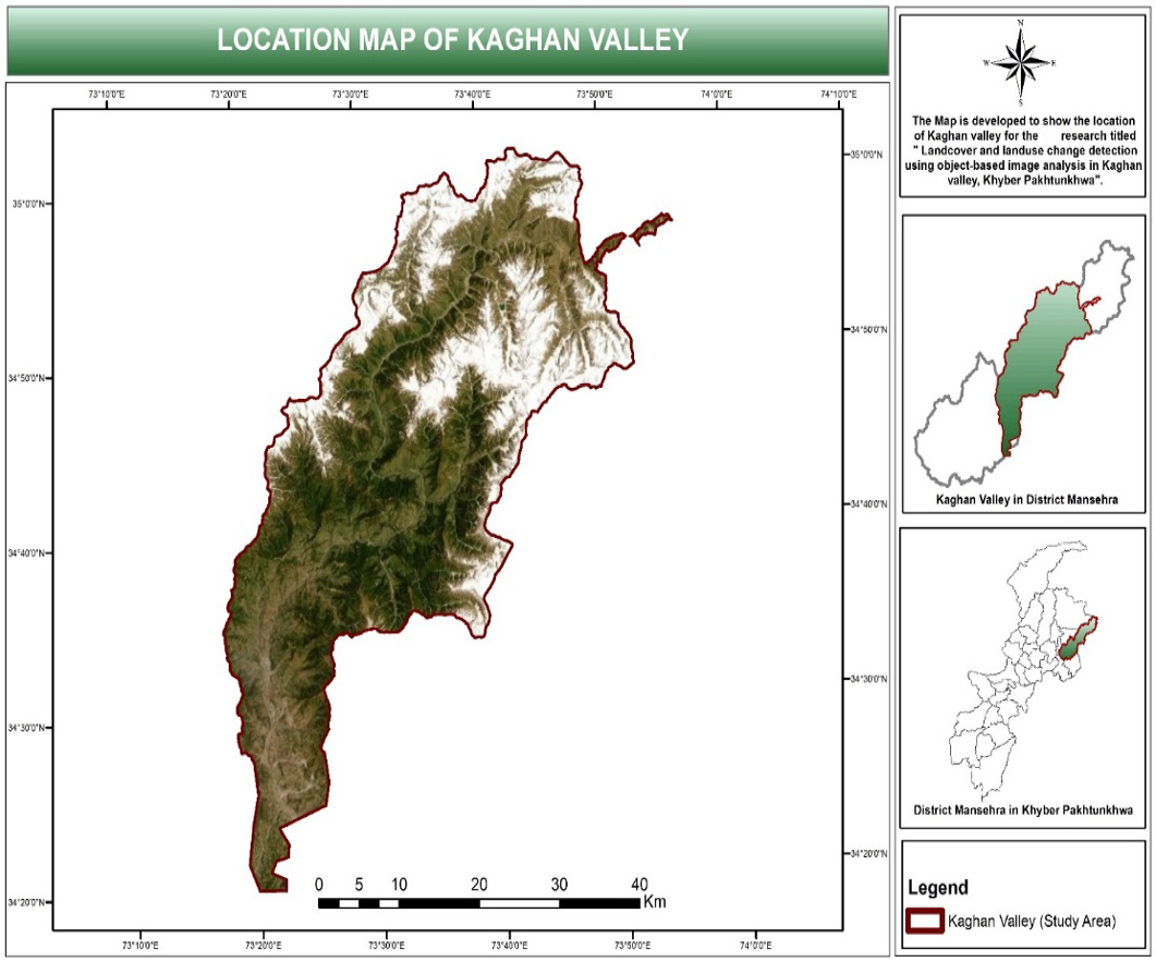
Figure 1:
Study area map.
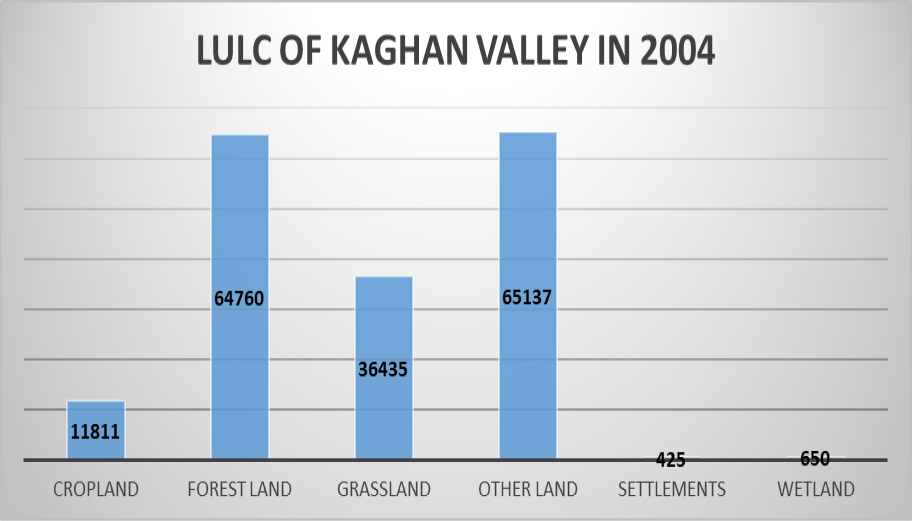
Figure 2:
LULC 2004.
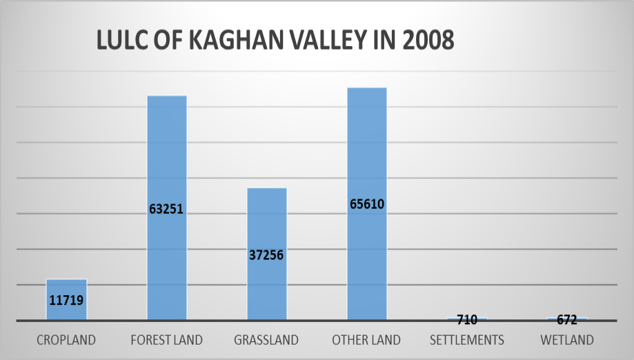
Figure 3:
LULC 2008.

Figure 4:
LULC 2012.
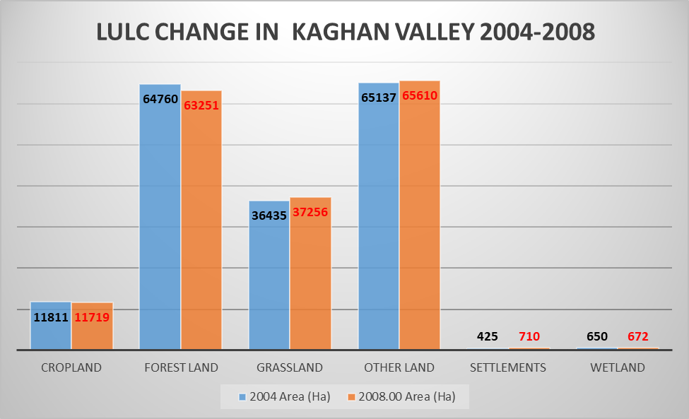
Figure 5:
LULC change from year 2004 to 2008.
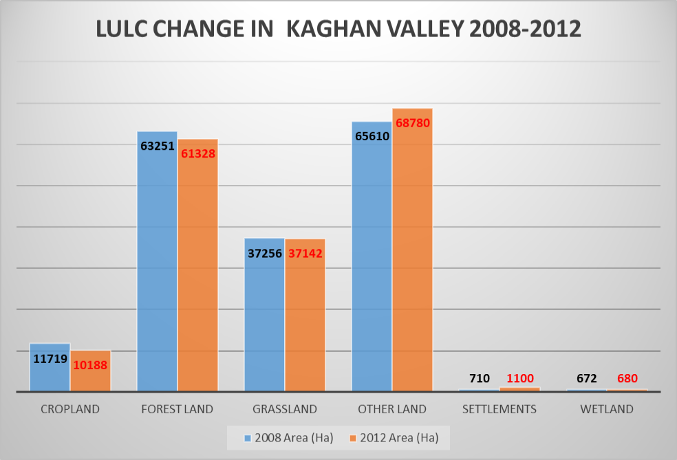
Figure 6:
LULC change from 2008 to 2012.
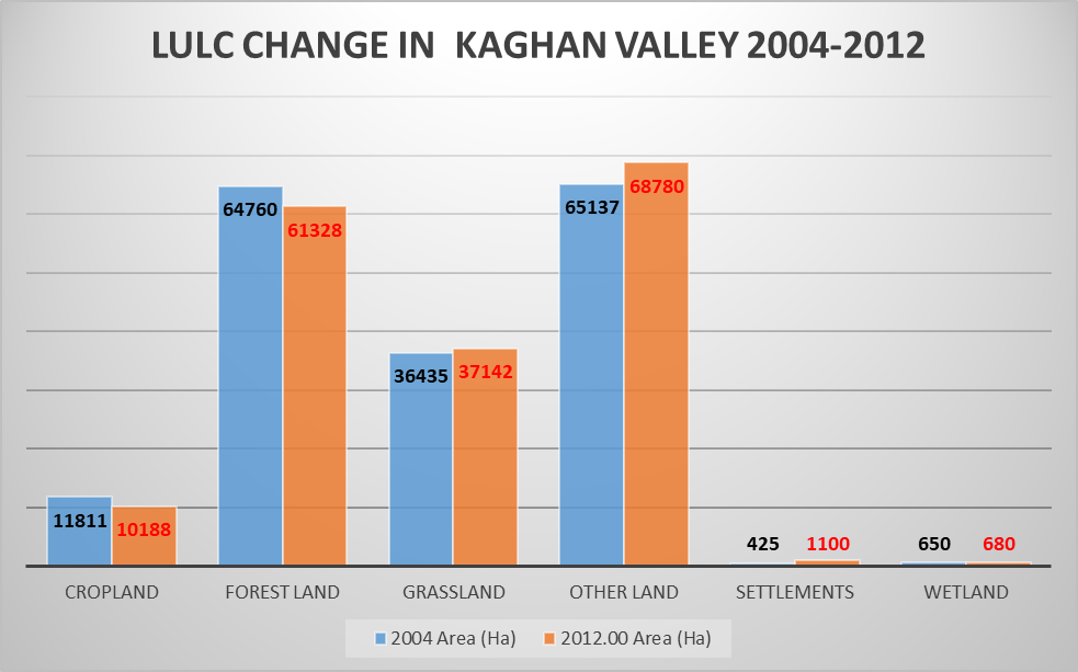
Figure 7:
LULC change from 2004 to 2012.

Figure 8:
LULC map 2004.

Figure 9:
LULC map 2008.
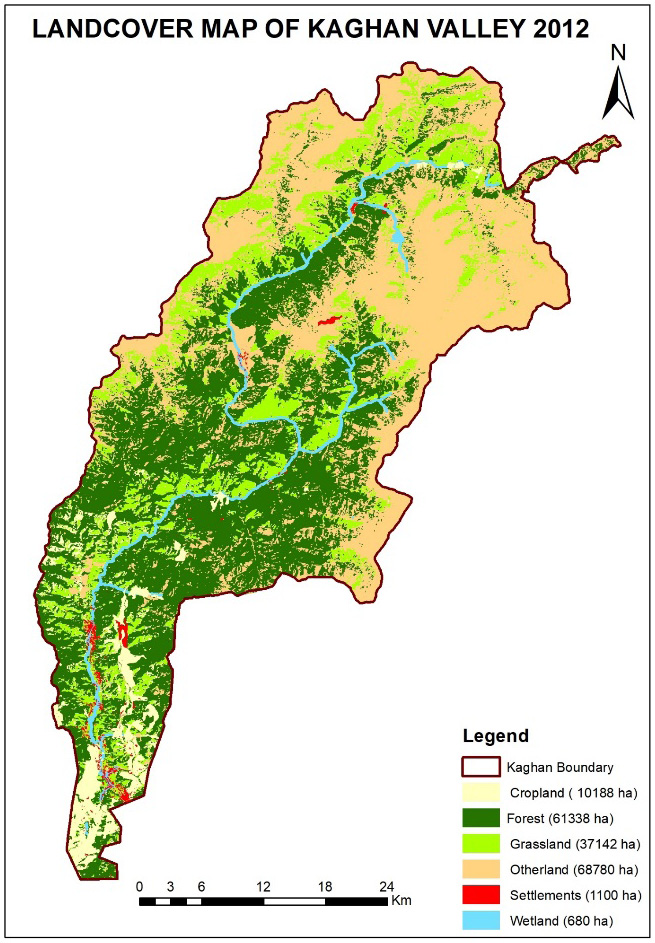
Figure 10:
LULC map 2012.

June 2022
Pakistan Journal of Forestry, Vol.72, Iss. 1, Pages 1-54
