
Investigation of Soil Erosion in Pothohar Plateau of Pakistan


Investigation of Soil Erosion in Pothohar Plateau of Pakistan
Chen Tongde1, Fakher Abbas1, Jiao Juying1, Shahzada Sohail Ijaz2*, An Shoshan1, Muhammad Ansar3, Qaiser Hussain2, Mah-Noor Azad2 andAyaz Ahmad2
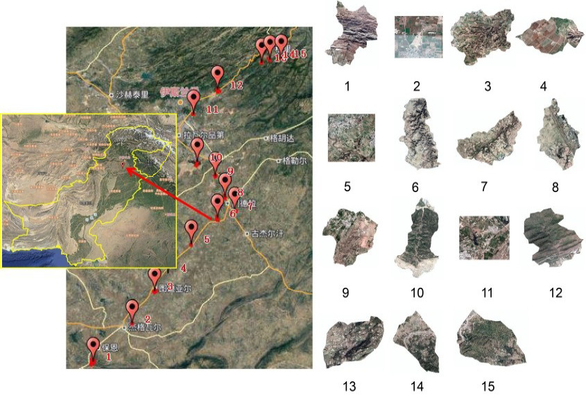
Figure 1:
Soil Erosion Survey Route and Distribution Location of Survey Units inPothohar Plateau, Pakistan.

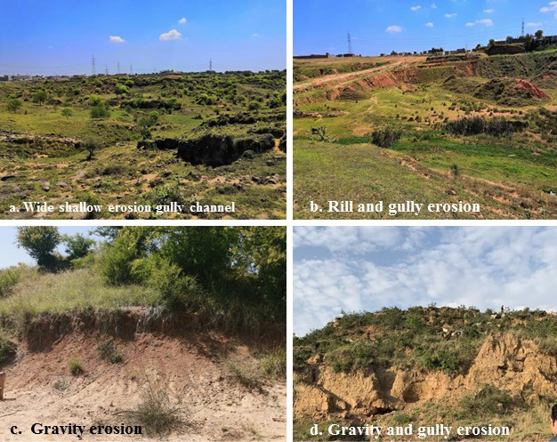
Figure 2:
a: Wide shallow erosion gully channel; b: Rill and gully erosion; c: Gravity erosion; d: Gravity and gully erosion.

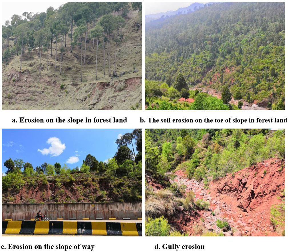
Figure 3:
Soil Erosion of Grasslands (Sparse Trees) in Gujar Khan Region (Taken by Jiao Juying from 2019-04-18 to 2019-04-19).
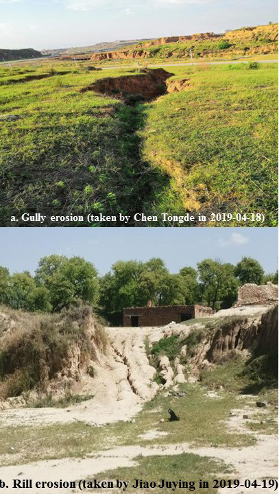
Figure 4:
Erosion Gully of Construction Land in Punjab and Northern Mindra in Islamabad Capital District.
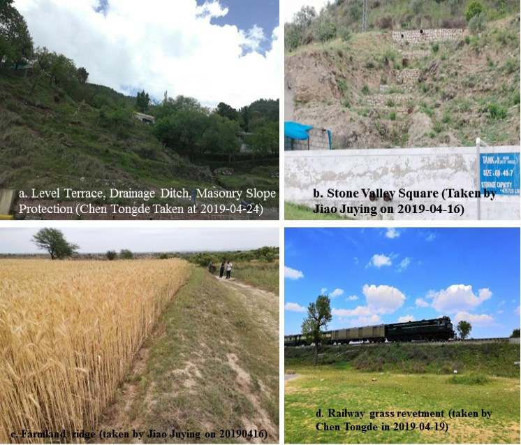
Figure 5:
Types of Soil and Water Conservation Measures in Pothohar Plateau.
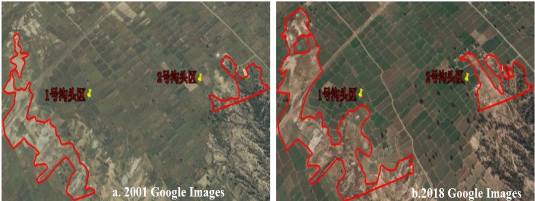
Figure 6
Gully head changes near research farm (URF) of PMAS Arid Agricultural University (near unit 4).

Figure 6
Gully head changes near research farm (URF) of PMAS Arid Agricultural University (near unit 4).

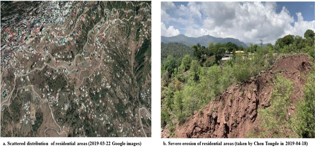
Figure 7:
Distribution of Residents in Murree Region.
June 2021
Vol. 34, Iss. 2, Pages 254-493

