


Assessment of Irrigation Development in the Small Dams Command Area: A Case Study of Palai Dam, District Charsadda
Muhammad Jamal Nasir*, Atiq Ur Rahman and Anwar Saeed Khan

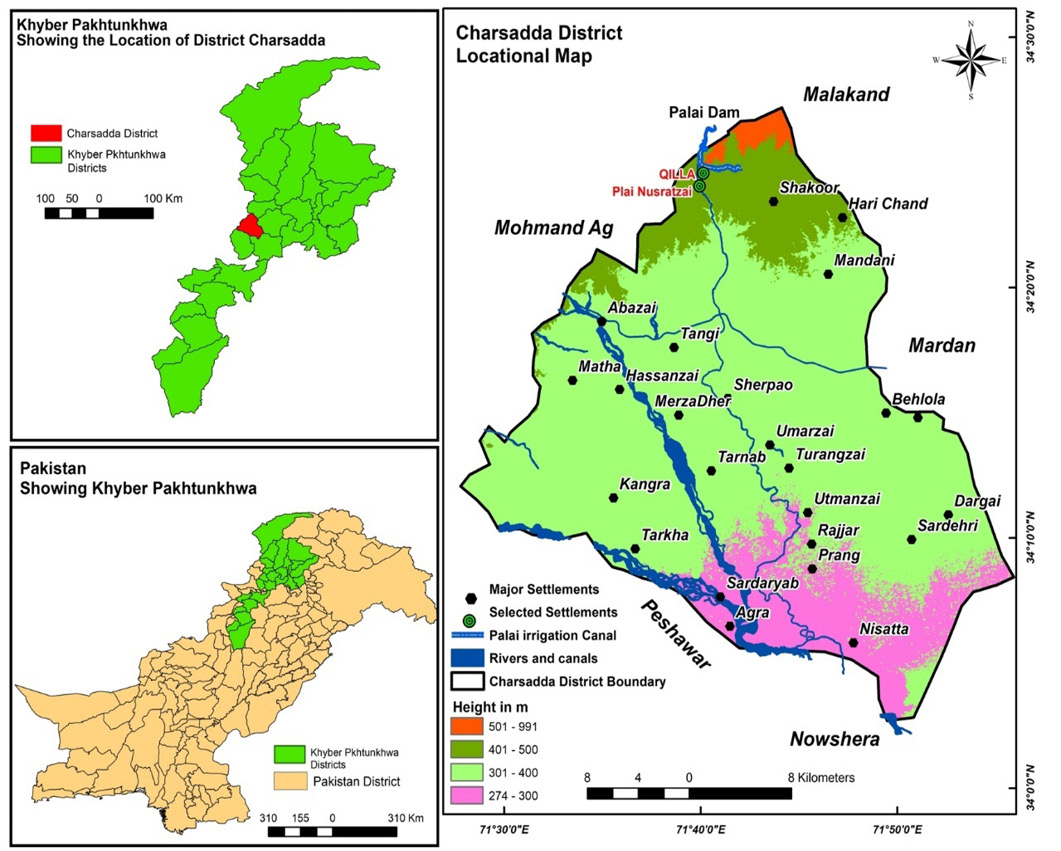
Location of study area.

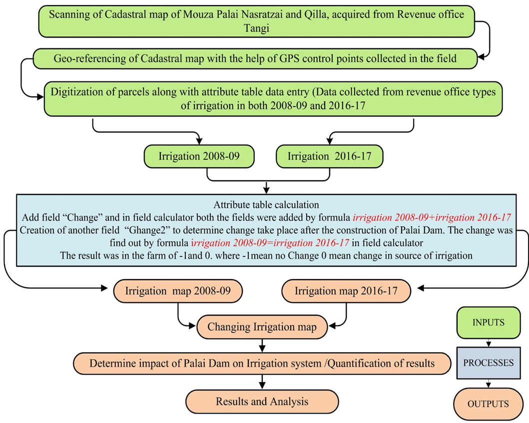
Methodology for analysis in ArcGIS 10.5.2.
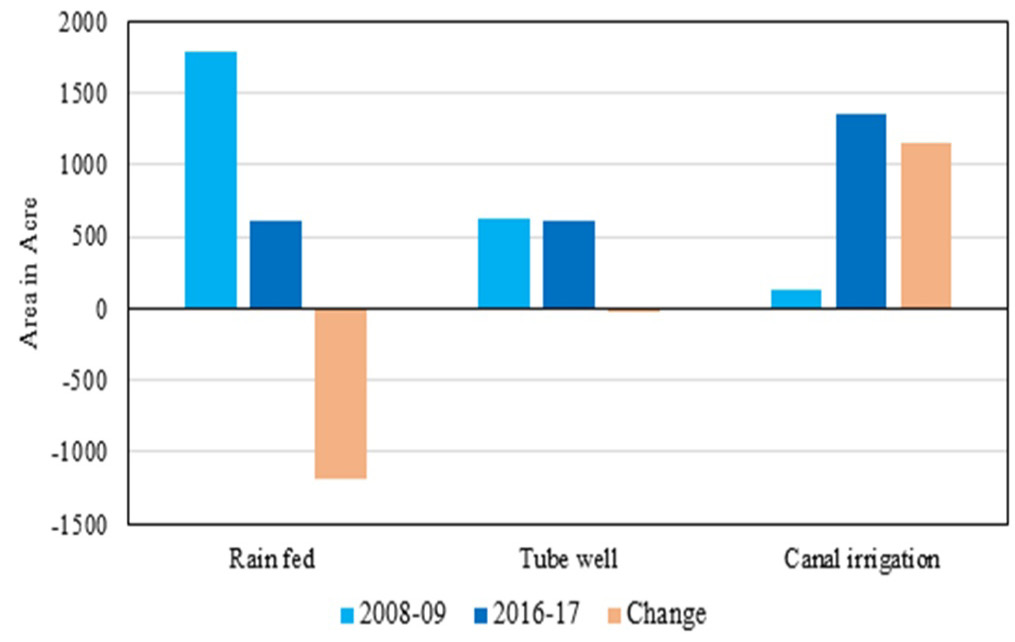
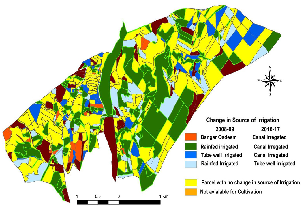
Village Palai Nasrat Zai, area under different irrigation source, 2008-09, 2016-17.
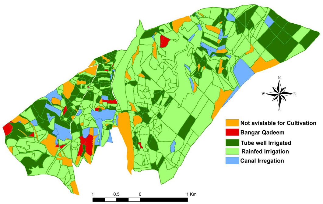
Source of irrigation and area under different irrigation sources of Mouza Palai Nasratzai in 2008-09.
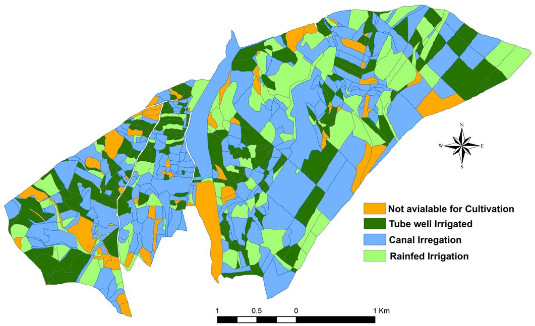
Source of irrigation and area under different irrigation sources of Mouza Palai Nasratzai in 2016-17.

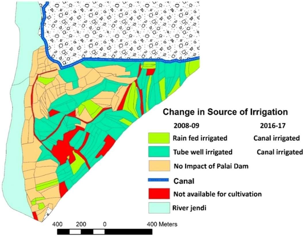
Change in the source of irrigation between 2008-09 and 2016-17. Source revenue record acquired from revenue office Tangi District Charsadda analyzed in ArcGIS 10.5.2.
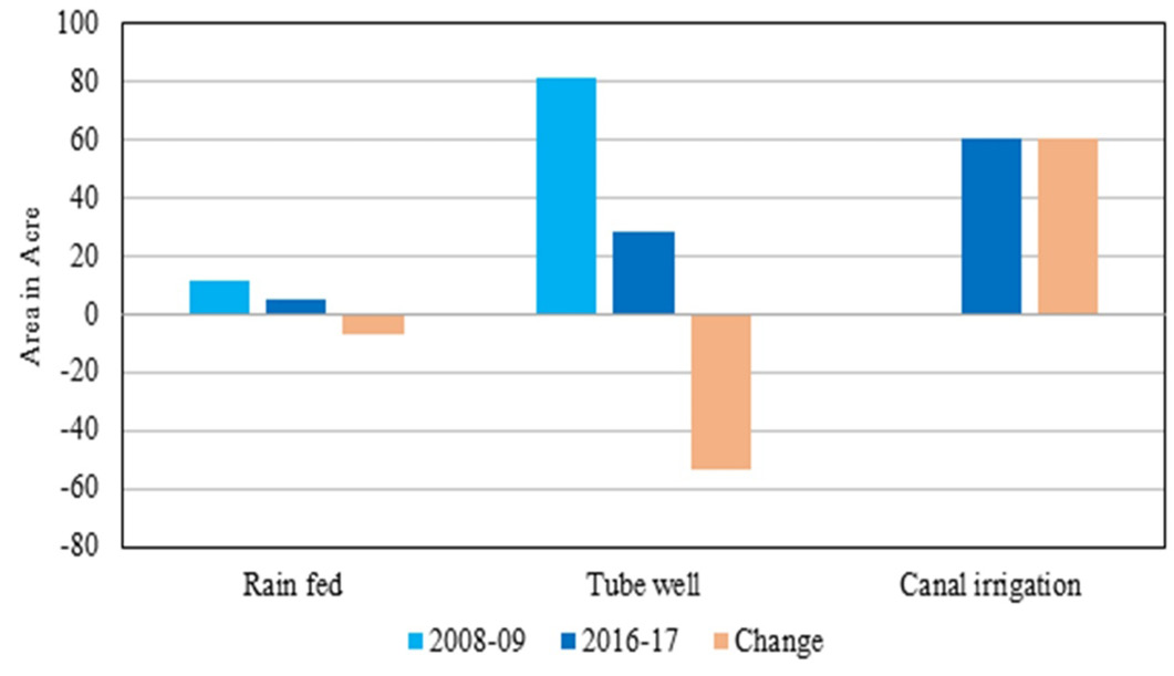
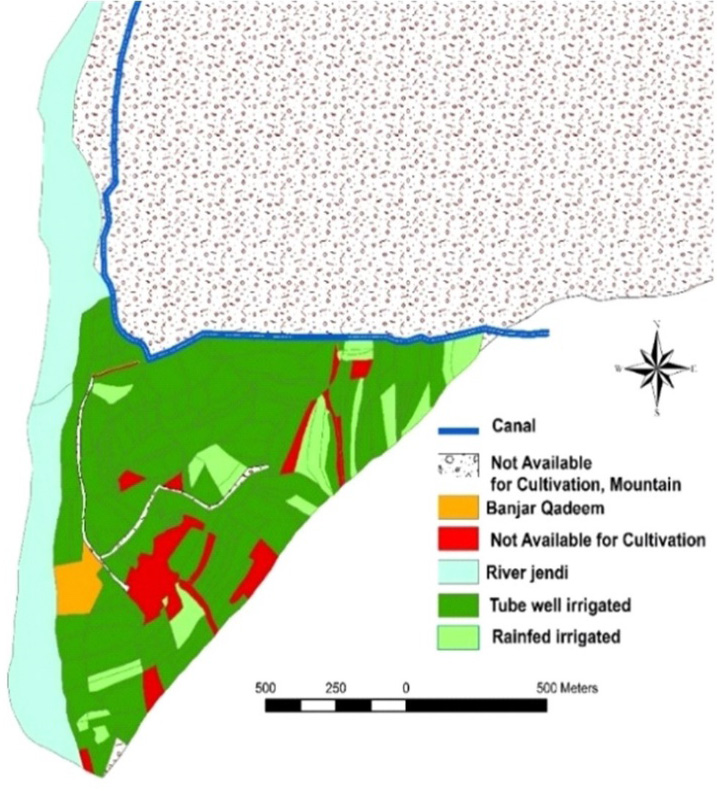
Village Qilla, area under different irrigation source, 2008-09, 2016-17.

Source of irrigation, irrigation system of Mouza Qilla, 2008-09. Based on analysis of revenue record acquired from revenue office Tangi district Charsadda.

Source of irrigation, irrigation system of Mouza Qilla, 2016-17. Based on analysis of revenue record acquired from revenue office Tangi district Charsadda.
Change in the source of irrigation, irrigation system of Mouza Qilla, 2008-09 to 2016-17. Based on analysis of revenue record acquired from revenue office Tangi district Charsadda.
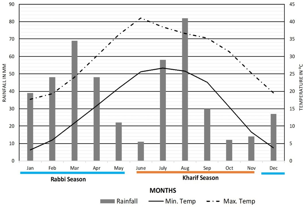
Climograph of District Charsadda.Figure 11: Climograph of District Charsadda.


