
Appraisal of Soil Erosion through RUSLE Model and Hypsometry in Chakwal Watershed (Potwar-Pakistan)


Appraisal of Soil Erosion through RUSLE Model and Hypsometry in Chakwal Watershed (Potwar-Pakistan)
Saira Batool1, Safdar Ali Shirazi1 and Syed Amer Mahmood2*
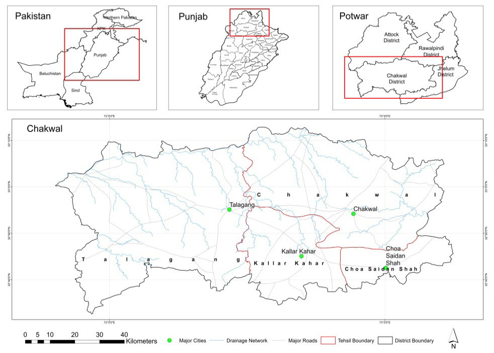
Figure 1:
Location of study area.
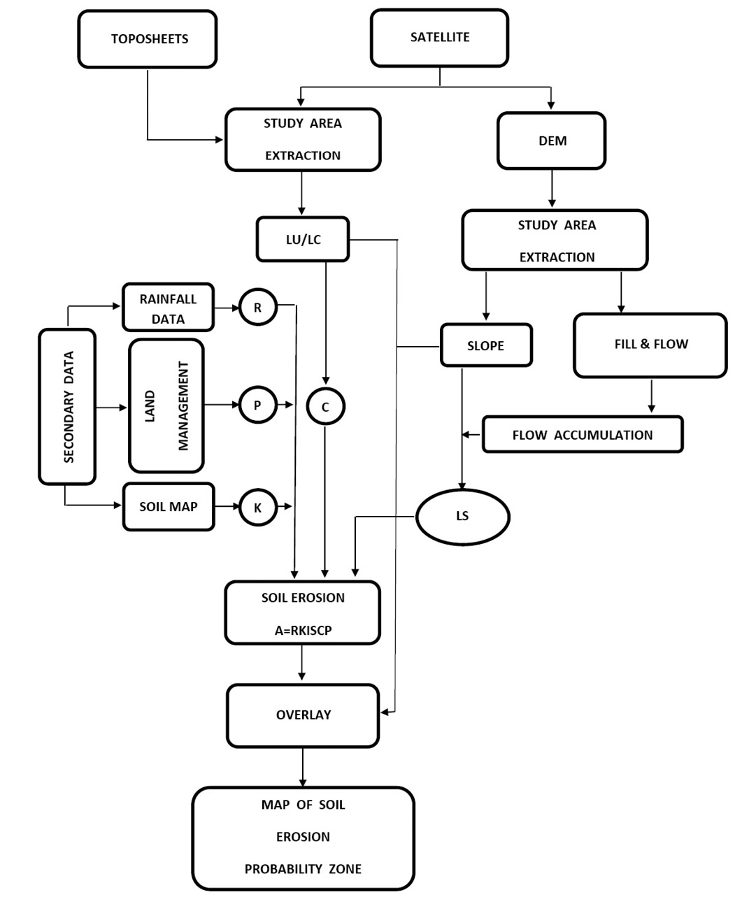
Figure 2:
Flow chart of methodology.
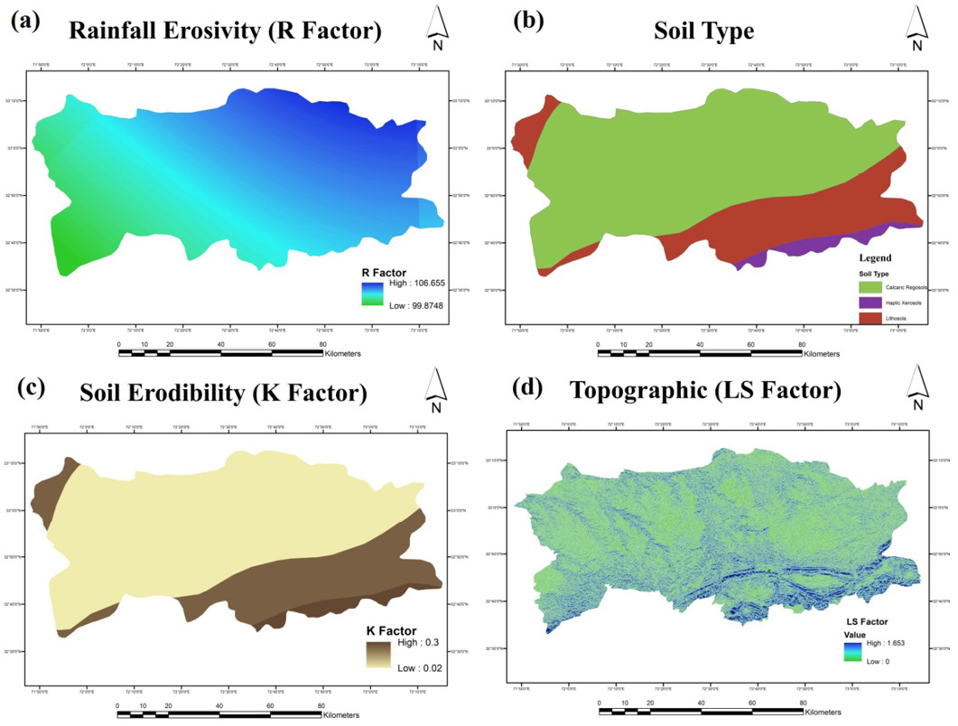
Figure 3:
Rainfall Erosivity factor (a), Soil Types (b), Soil Erodibility factor (c) and Topographic LS-Factor (d).

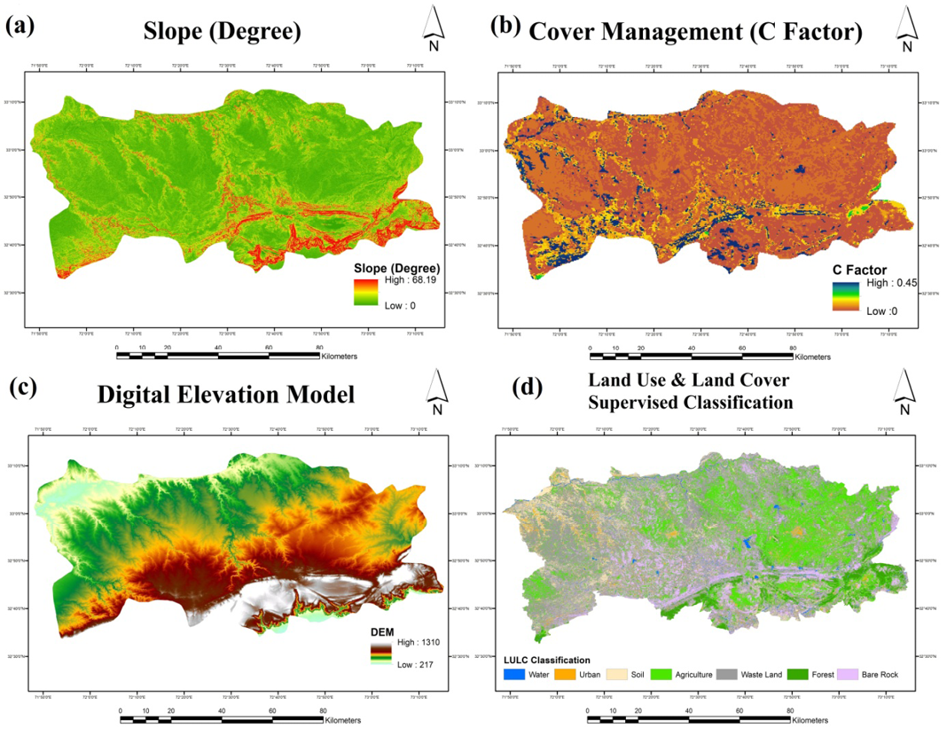
Figure 4:
Slope in degrees (a), Cover Management Factor (b), Digital Elevation Model (c) and Landuse/Landcover map (d).

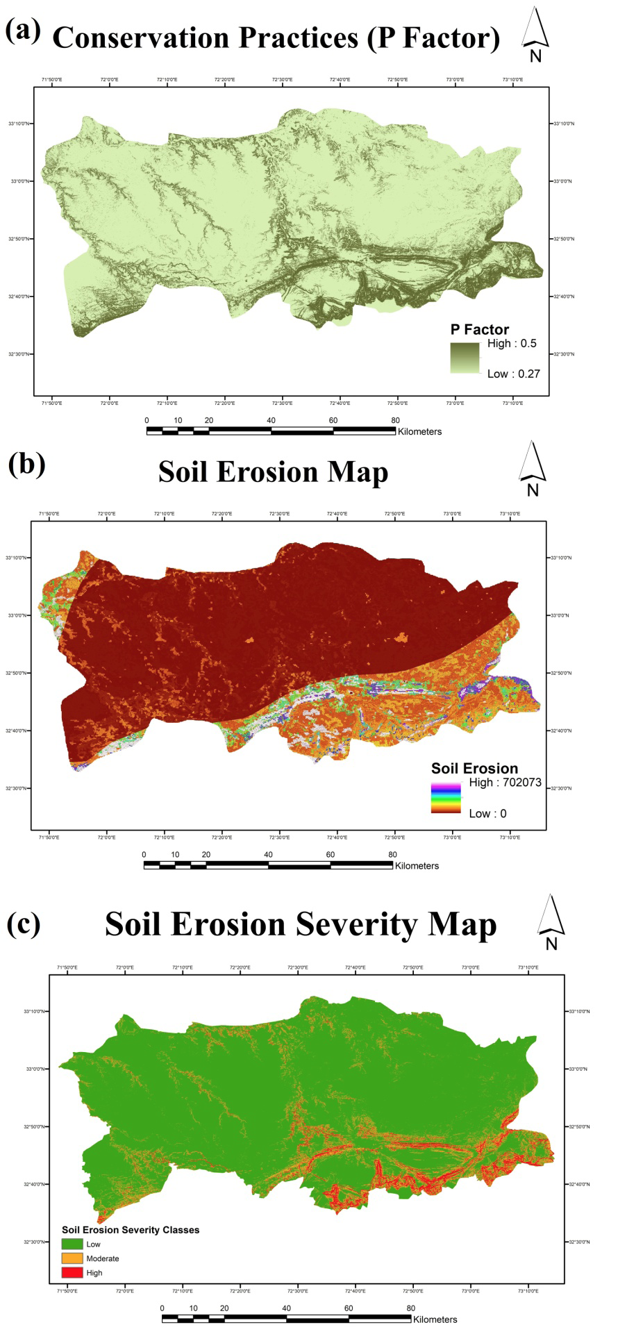
Figure 5:
Conservation practices (a), soil erosion map (b) and soil erosion severity map (c).

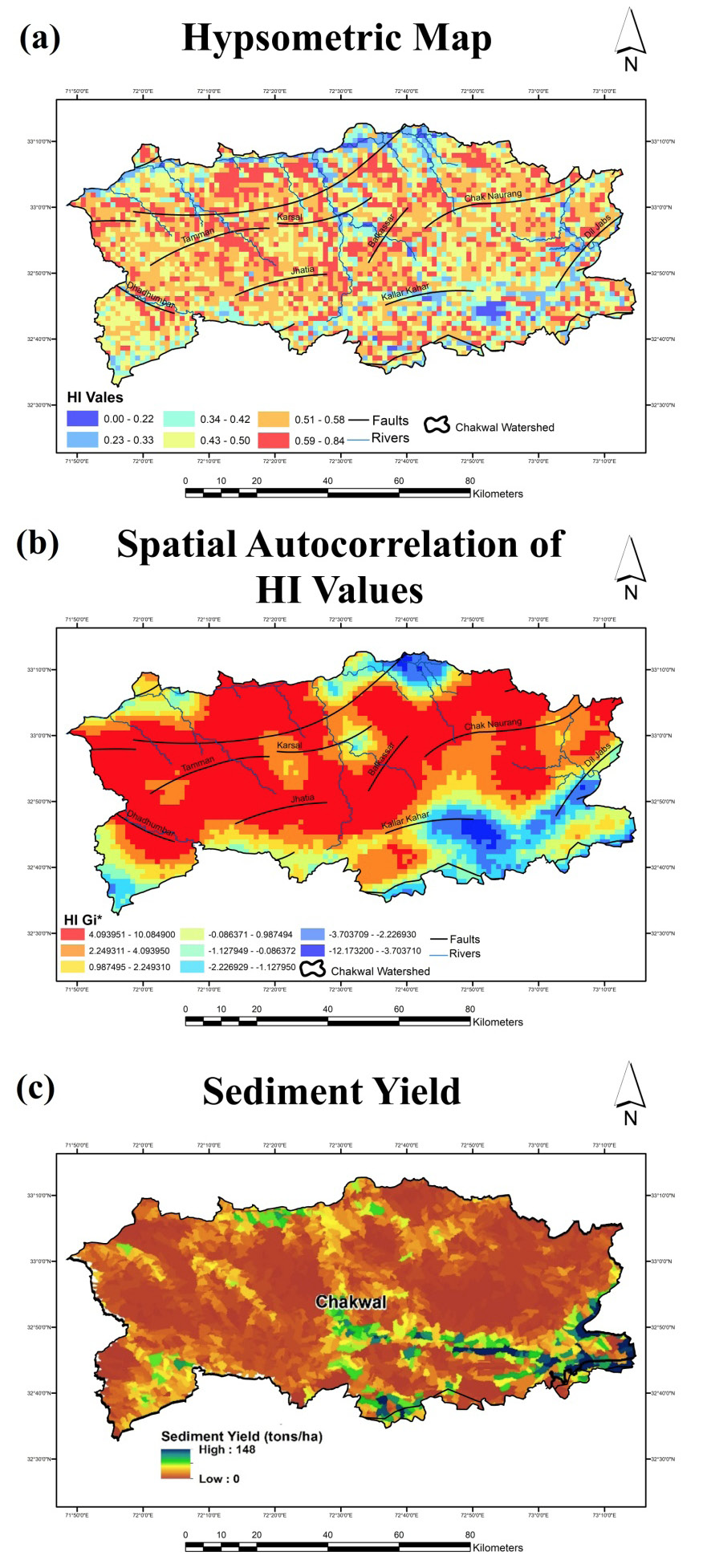
Figure 6:
Hypsometric map (a), Spatial auto-correlation map of HI values (b) and Sediment yield for Chakwal district (c).
June 2021
Vol. 37, Iss. 2, Pages 331-713

