
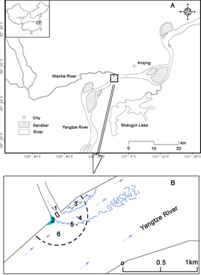
Fig. 1.
The location of the estuary of Wanhe River (A) and the divided six different zones (B): 1 flow deflection; 2 flow stagnation; 3 flow separation; 4 maximum velocity; 5 shear layer; 6 mainstream. Black rectangle represents the observation boat and the dotted curve represents the observation area.