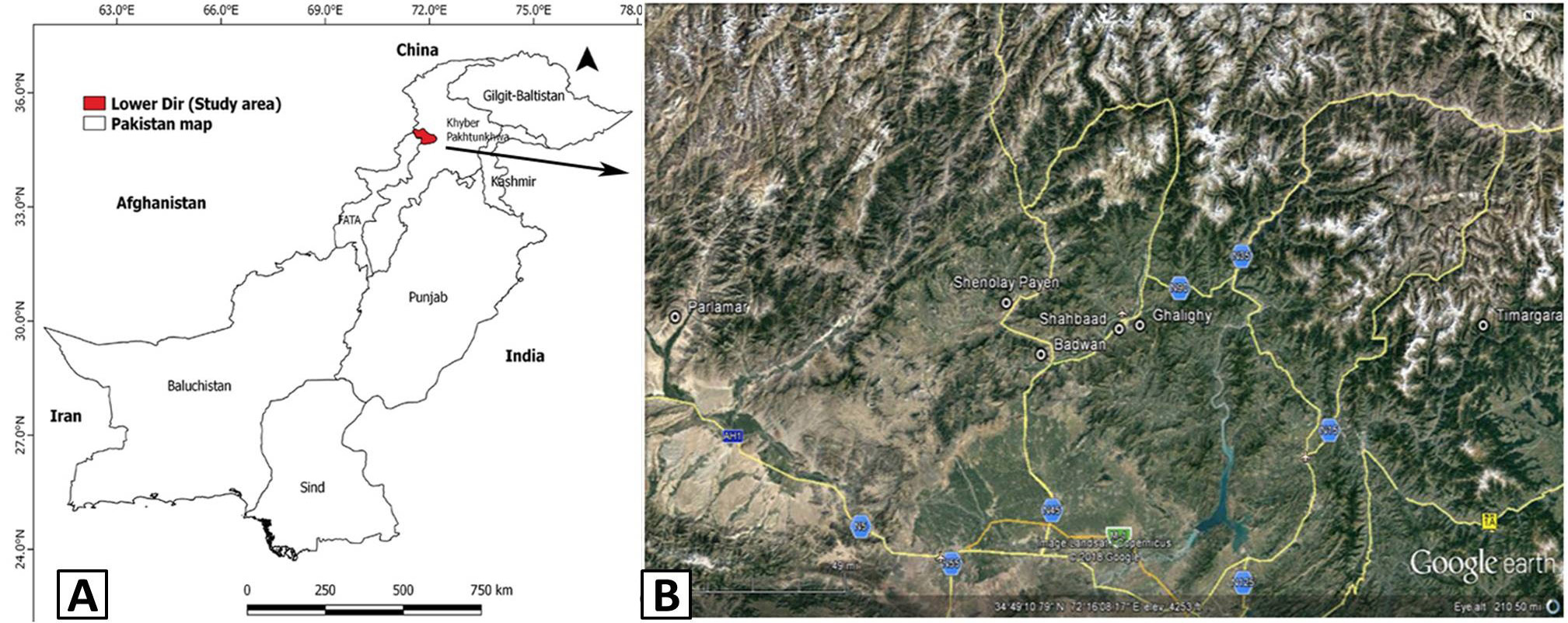
Fig. 1.
A, Map of Pakistan showing location of Lower Dir District (shaded) the study area. B, a satellite image of the area showing sampling sites (modified from Google Earth). The seven sampling sites used for data collection, including Shahbaad, Parlamar, Shenolay Payen, Ghalighy, Timargara, Badwan and Loi Shodshing.