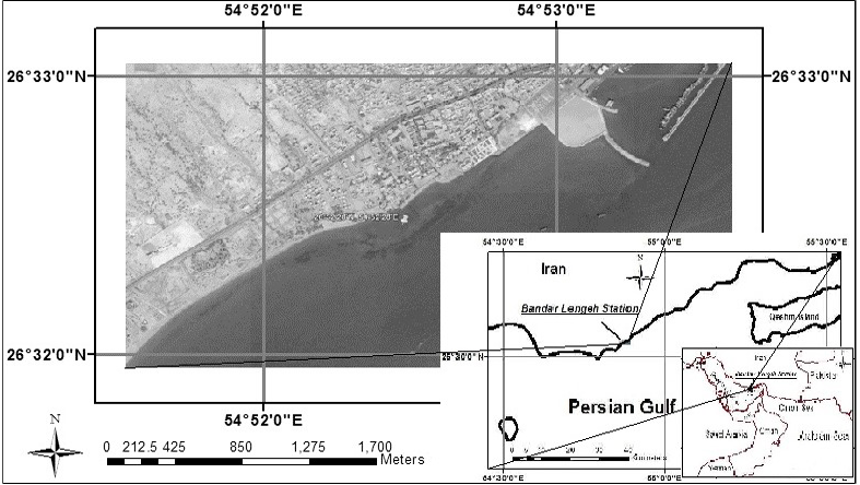
Fig 1
A map of study area, Bandar Lengeh, in the Persian Gulf. Bottom left corner: The position of Persian Gulf; Bottom left middle: The position of Bandar Lengeh (map source: Iranian Army Geographic Agency); and finally the position of the station in Bandar Lengeh (map source: Google Earth). The rocky coasts are obvious in this map.